File:Able1952 map.PNG
Jump to navigation
Jump to search
No higher resolution available.
Able1952_map.PNG (542 × 536 pixels, file size: 195 KB, MIME type: image/png)
File history
Click on a date/time to view the file as it appeared at that time.
| Date/Time | Thumbnail | Dimensions | User | Comment | |
|---|---|---|---|---|---|
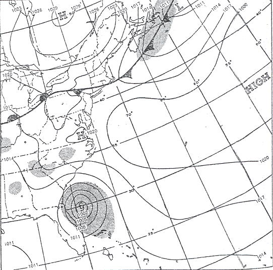
| current | 19:15, 13 January 2011 | | 542 × 536 (195 KB) | commons>Hurricanehink | {{Information |Description={{en|1=Surface weather map for 1230 GMT, August 30, 1952. Shading indicates areas of active precipitation Hurricane Able is seen at the bottom of the image, about to strike South Carolina}} |Source=http://www.aoml.noaa.gov/gene |
File usage
There are no pages that use this file.