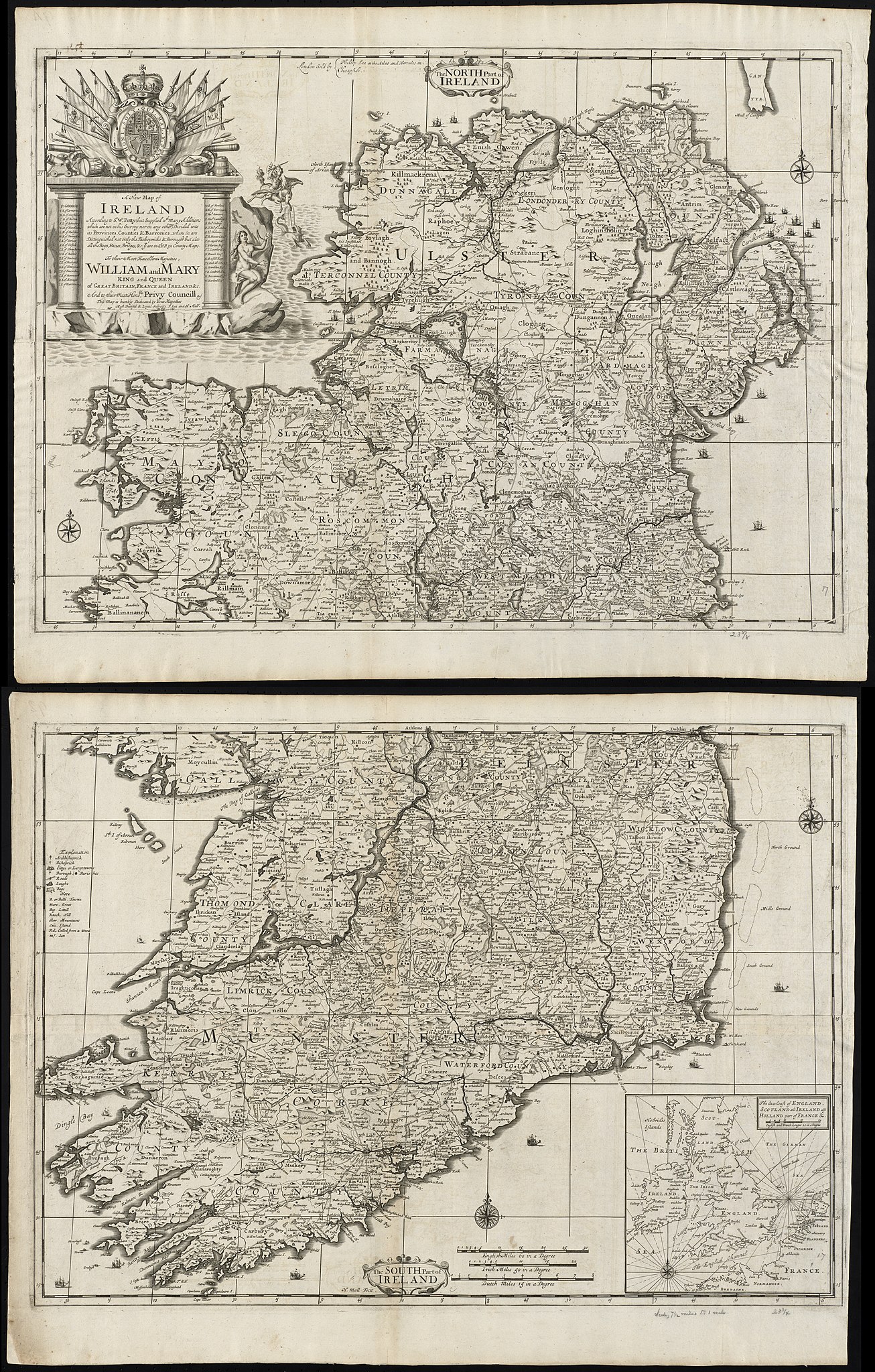
File:A new map of Ireland according to Sr. W. Petty (but supplied wth. many additions which are not in his survey nor in any other map) divided into its provinces, counties & barronies ... county maps (8643652942).jpg
Jump to navigation
Jump to search

Size of this preview: 382 × 599 pixels. Other resolutions: 153 × 240 pixels | 306 × 480 pixels | 489 × 768 pixels | 653 × 1,024 pixels | 1,306 × 2,048 pixels | 5,446 × 8,542 pixels.
Original file (5,446 × 8,542 pixels, file size: 20.4 MB, MIME type: image/jpeg)
_divided_into_its_provinces,_counties_%26_barronies_..._county_maps_(8643652942).jpg)
File history
Click on a date/time to view the file as it appeared at that time.
| Date/Time | Thumbnail | Dimensions | User | Comment | |
|---|---|---|---|---|---|
| current | 12:35, 7 December 2020 | | 5,446 × 8,542 (20.4 MB) | commons>Ww2censor | Highest resolution from Boston Public Library's original source tif converted to jpg - previous version seems messed up |
File usage
There are no pages that use this file.
_divided_into_its_provinces,_counties_%26_barronies_..._county_maps_(8643652942).jpg)