File:90907 deir rafat monastery PikiWiki Israel.jpg
Original file (1,854 × 3,292 pixels, file size: 1.59 MB, MIME type: image/jpeg)
This file is from a shared repository and may be used by other projects. The description on its file description page there is shown below.
Description90907 deir rafat monastery PikiWiki Israel.jpg |
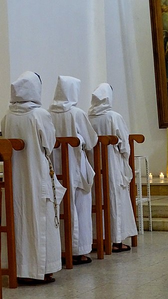
English: Deir Rafat Monastery עברית: מנזר דיר ראפאת
Original Image Name: Piciwiki_israel_90907_DSC01991.JPG Notes: המנזר הוקם ב 1927 על ידי הבישוף האיטלקי פארינה, מייסד מסדר האחיות דורותי הקדושה ובעידודו של ידי הפטריארך הלטיני לואיג'י ברלסינה לאחר רעידת האדמה שהתחוללה בארץ. הפטריארך היה מעוניין באתר לכבוד מרים אם ישו שתגן על ארץ ישראל מפני אסונות דומים. לכן שמה הרשמי של הכנסייה הוא "גבירתנו מלכת פלשתינה" ("Regina Palaestinae"). לצד הקמת הכנסייה נקבע יום חג החל מדי שנה ביום ראשון שלאחר ה-25 באוקטובר. ב 1933 אישר הותיקן את החג הזה.את המבנים במתחם המנזר תכנן הנזיר הבנדיקטיני והאדריכל האב מורציו גיסלר.(ויקיפדיה) Location: צפונית-מערבית לבית שמש ולקיבוץ צרעה, |
Date | 6.10.2022 |
Source | Zalmanson Zeller via the PikiWiki - Israel free image collection project |
Author | israel zeller ישראל זלר |
Permission (Reusing this file) |
This file is licensed under the Creative Commons Attribution 2.5 Generic license. Attribution: Zeller Zalmanson Pikiwiki Israel
|
This file has been submitted through the Israeli Pikiwiki project and uploaded here automatically.
The project is cooperation between the Israel Internet Association and Wikimedia Israel in an effort to promote the concept of free content on the Web, by creating an image collection of digital-format, good quality photographs, documenting events relating to the history of Israel, or depicting places of distinction in Israel and the Middle East. The Pikiwiki Project is managed from 2021 by the "Heritage Stones" group.
Please consider notifying the project before renaming or deleting this file. Further information about the project can be found on the commons-l mailing list.
|
Items portrayed in this file
depicts
0.0125 second
4.5
15.64 millimetre
1,250
image/jpeg
b3c0a3eaccc7f9ec06047d7d023efa91c26939e7
1,662,001 byte
3,292 pixel
1,854 pixel
File history
Click on a date/time to view the file as it appeared at that time.
Date/Time | Thumbnail | Dimensions | User | Comment | |
---|---|---|---|---|---|
current | 01:28, 16 October 2022 | 1,854 × 3,292 (1.59 MB) | commons>Pikiwikisrael |
File usage
There are no pages that use this file.
Metadata
This file contains additional information, probably added from the digital camera or scanner used to create or digitize it.
If the file has been modified from its original state, some details may not fully reflect the modified file.
Camera manufacturer | SONY |
---|---|
Camera model | DSC-HX400V |
Exposure time | 1/80 sec (0.0125) |
F Number | f/4.5 |
ISO speed rating | 1,250 |
Date and time of data generation | 11:08, 6 October 2022 |
Lens focal length | 15.64 mm |
Latitude | 31° 46′ 33.69″ N |
Longitude | 34° 56′ 47.81″ E |
Altitude | 273.1 meters above sea level |
Orientation | Normal |
Horizontal resolution | 350 dpi |
Vertical resolution | 350 dpi |
Software used | ACDSee Ultimate 2020 |
File change date and time | 14:24, 9 October 2022 |
Y and C positioning | Centered |
Exposure Program | Normal program |
Exif version | 2.3 |
Date and time of digitizing | 11:08, 6 October 2022 |
Meaning of each component |
|
Image compression mode | 2 |
APEX brightness | 2.99765625 |
APEX exposure bias | 0 |
Maximum land aperture | 4 APEX (f/4) |
Metering mode | Center weighted average |
Light source | Unknown |
Flash | Flash did not fire, compulsory flash suppression |
DateTime subseconds | 379 |
Supported Flashpix version | 1 |
Color space | sRGB |
File source | Digital still camera |
Scene type | A directly photographed image |
Custom image processing | Normal process |
Exposure mode | Auto exposure |
White balance | Auto white balance |
Digital zoom ratio | 1 |
Scene capture type | Standard |
Contrast | Normal |
Saturation | Normal |
Sharpness | Normal |
GPS time (atomic clock) | 08:08 |
Receiver status | Measurement in progress |
Measurement mode | 3-dimensional measurement |
Measurement precision | Good (3.66) |
Speed unit | Kilometers per hour |
Speed of GPS receiver | 0.96 |
Reference for direction of movement | True direction |
Direction of movement | 158 |
Geodetic survey data used | WGS-84 |
GPS date | 6 October 2022 |
GPS differential correction | 0 |
GPS tag version | 0.0.3.2 |