File:5tunnelmarp.png
Jump to navigation
Jump to search

Size of this preview: 744 × 600 pixels. Other resolutions: 298 × 240 pixels | 595 × 480 pixels | 996 × 803 pixels.
Original file (996 × 803 pixels, file size: 224 KB, MIME type: image/png)
File history
Click on a date/time to view the file as it appeared at that time.
| Date/Time | Thumbnail | Dimensions | User | Comment | |
|---|---|---|---|---|---|
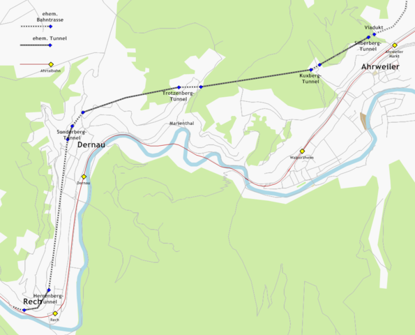
| current | 20:10, 2 August 2009 | | 996 × 803 (224 KB) | commons>Zeitan~commonswiki | {{Information |Description={{de|1=Strategischer Bahndamm, Strecke zwischen Ahrweiler und Rech. Hintergrundkarte: openstreetmap.org. Vermuteter Streckenverlauf und Lage der Tunnelportale: eigene Erhebung.}} |Source=Own work by uploader |Author=[[User:Zeita |
File usage
There are no pages that use this file.