File:506-Castile 1210.png
Jump to navigation
Jump to search
No higher resolution available.
506-Castile_1210.png (474 × 506 pixels, file size: 138 KB, MIME type: image/png)
File history
Click on a date/time to view the file as it appeared at that time.
| Date/Time | Thumbnail | Dimensions | User | Comment | |
|---|---|---|---|---|---|
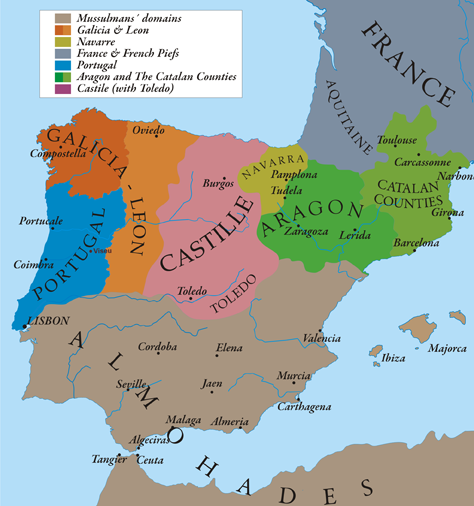
| current | 20:58, 12 May 2010 | | 474 × 506 (138 KB) | commons>Alexandre Vigo~commonswiki | {{Information |Description={{en|1=This map show Al-Andalus (Almohades) and European Christian kingdoms. 12th-13th centuries. It´s made from "The Historical Atlas by William R. Shepherd, 1926".}} |Source={{own}} |Author=[[User:Alexandre Vigo|Alexandre Vig |
File usage
There are no pages that use this file.