File:2022 East Timor Atauro locator map.png
Jump to navigation
Jump to search

Size of this preview: 800 × 461 pixels. Other resolutions: 320 × 185 pixels | 640 × 369 pixels | 1,024 × 591 pixels | 1,280 × 738 pixels | 3,344 × 1,929 pixels.
Original file (3,344 × 1,929 pixels, file size: 175 KB, MIME type: image/png)
File history
Click on a date/time to view the file as it appeared at that time.
| Date/Time | Thumbnail | Dimensions | User | Comment | |
|---|---|---|---|---|---|
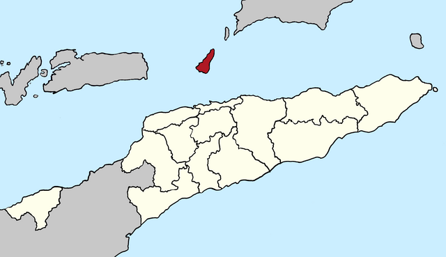
| current | 19:48, 4 April 2022 | | 3,344 × 1,929 (175 KB) | commons>J. Patrick Fischer | {{Information |description={{de|1=Lagekarte der Gemeinde Atauro seit 2022, Osttimor}} {{en|1=Locator map of Atauro municipality since 2022, East Timor}} |date=2022-04-04 |source={{own}} |author=J. Patrick Fischer |permission= |other versions= }} =={{int:license-header}}== {{self|cc-by-sa-4.0}} Category:Locator Maps of municipalities of East Timor Category:Maps of Subdivisions of East Timor Category:Maps of Atauro |
File usage
There are no pages that use this file.