File:2008-Colombia earthquake intensity-map.jpg
Jump to navigation
Jump to search
Size of this preview: 518 × 599 pixels. Other resolutions: 207 × 240 pixels | 612 × 708 pixels.
Original file (612 × 708 pixels, file size: 123 KB, MIME type: image/jpeg)
File history
Click on a date/time to view the file as it appeared at that time.
| Date/Time | Thumbnail | Dimensions | User | Comment | |
|---|---|---|---|---|---|
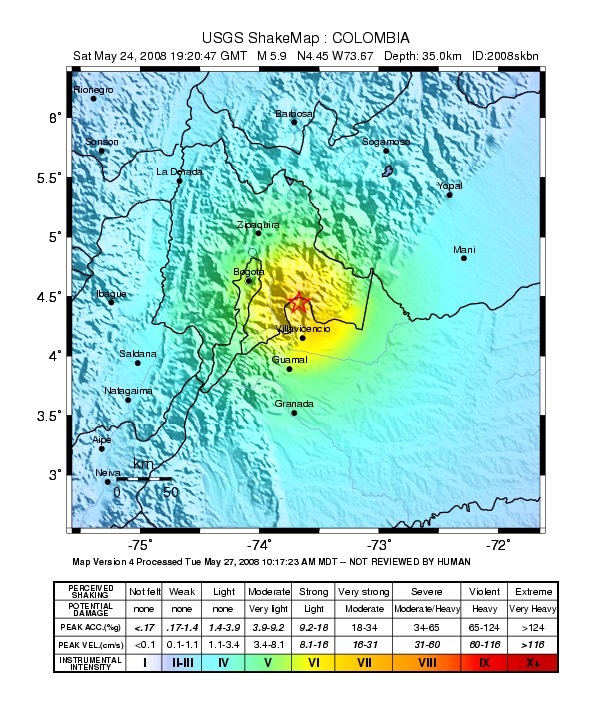
| current | 21:41, 22 August 2008 | | 612 × 708 (123 KB) | commons>AstroImager001 | {{Information |Description=File from USGS, ShakeMap of May 2008 Colombia earthquake |Source=http://earthquake.usgs.gov/eqcenter/shakemap/global/shake/2008skbn/ |Date=2008-05-24 |Author=United States Geological Survey |Permission=Public domain, USGS federa |
File usage
There are no pages that use this file.