File:1989 Newcastle earthquake map.png
Jump to navigation
Jump to search

Size of this preview: 704 × 599 pixels. Other resolutions: 282 × 240 pixels | 564 × 480 pixels | 902 × 768 pixels | 1,203 × 1,024 pixels | 1,500 × 1,277 pixels.
Original file (1,500 × 1,277 pixels, file size: 1.07 MB, MIME type: image/png)
File history
Click on a date/time to view the file as it appeared at that time.
| Date/Time | Thumbnail | Dimensions | User | Comment | |
|---|---|---|---|---|---|
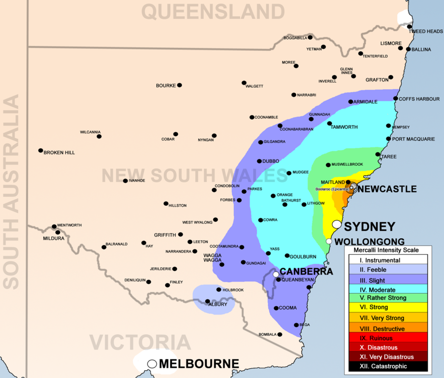
| current | 08:49, 1 June 2008 | | 1,500 × 1,277 (1.07 MB) | commons>Bidgee | {{Information |Description={{en|1=1989 Newcastle earthquake map base on [http://www.ema.gov.au/agd/EMA/emaSchools.nsf/Page/Lesson_Plans_Student_Worksheet_Student_Worksheet_-_Earthquakes], [http://www.ncc.nsw.gov.au/discover_newcastle/local_history/newcast |
File usage
There are no pages that use this file.