File:1967-USGSTopoMapExcerpt.jpg
Jump to navigation
Jump to search
No higher resolution available.
1967-USGSTopoMapExcerpt.jpg (628 × 393 pixels, file size: 96 KB, MIME type: image/jpeg)
File history
Click on a date/time to view the file as it appeared at that time.
| Date/Time | Thumbnail | Dimensions | User | Comment | |
|---|---|---|---|---|---|
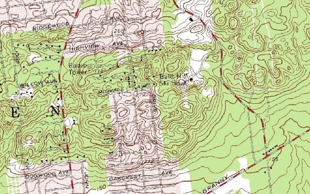
| current | 13:45, 27 August 2009 | | 628 × 393 (96 KB) | commons>Neighborhoodpalmreader | {{Information |Description={{en|1=United States Geological Survey map excerpt showing the Bald Hill Ski Bowl area in Farmingville, New York}} |Source=Except of scan of 1967 USGS |Author= United States Geological Survey |Date=1967 |Permission=See below | |
File usage
There are no pages that use this file.