File:1942 Usumbura map Ruanda Urundi txu-oclc-8161454-sheet19 kasha.jpg
Jump to navigation
Jump to search

Size of this preview: 590 × 599 pixels. Other resolutions: 236 × 240 pixels | 473 × 480 pixels | 756 × 768 pixels | 1,008 × 1,024 pixels | 2,016 × 2,048 pixels | 3,297 × 3,349 pixels.
Original file (3,297 × 3,349 pixels, file size: 2.8 MB, MIME type: image/jpeg)
File history
Click on a date/time to view the file as it appeared at that time.
| Date/Time | Thumbnail | Dimensions | User | Comment | |
|---|---|---|---|---|---|
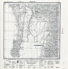
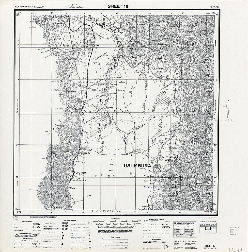
| current | 11:33, 16 October 2017 | | 3,297 × 3,349 (2.8 MB) | commons>M2545 | {{Information |Description=Map of Ruanda-Urundi, showing location of Usumbura (i.e. Bujumbura) and other towns/villages. Part of: Ruanda-Urundi 1:100,000 (1942). U.S. Army Map Service, Series Z621. |Source=University of Texas at Austin, Perry-Castañed... |
File usage
There are no pages that use this file.