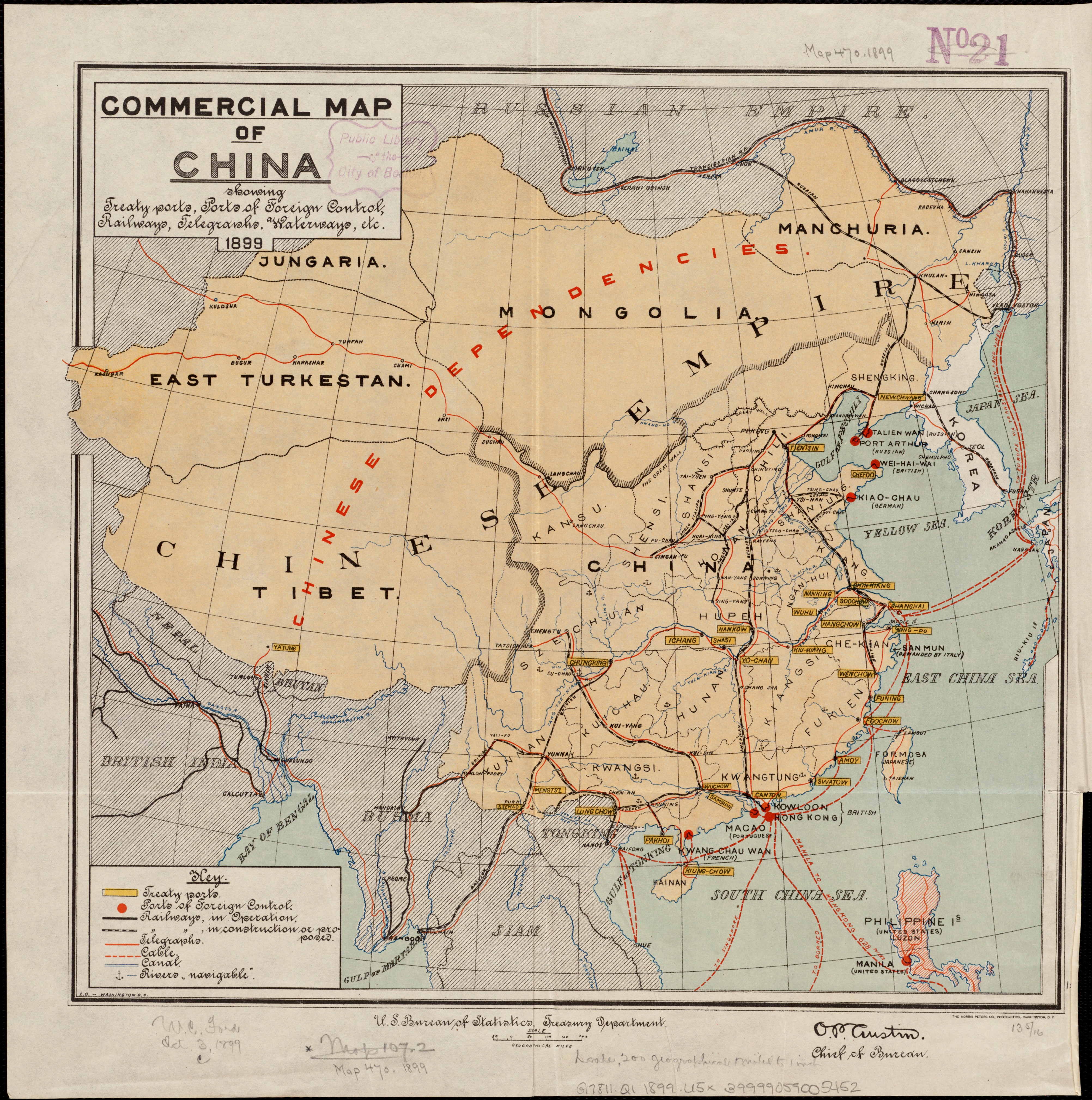
File:1899 United States Government Commercial map of China, showing treaty ports, ports of foreign control, railways, telegraphs, waterways.jpg
Jump to navigation
Jump to search
Size of this preview: 595 × 599 pixels. Other resolutions: 238 × 240 pixels | 477 × 480 pixels | 763 × 768 pixels | 1,017 × 1,024 pixels | 2,034 × 2,048 pixels | 4,008 × 4,036 pixels.
Original file (4,008 × 4,036 pixels, file size: 4.37 MB, MIME type: image/jpeg)
File history
Click on a date/time to view the file as it appeared at that time.
| Date/Time | Thumbnail | Dimensions | User | Comment | |
|---|---|---|---|---|---|
| current | 08:49, 22 September 2018 | | 4,008 × 4,036 (4.37 MB) | commons>Onceinawhile | User created page with UploadWizard |
File usage
There are no pages that use this file.