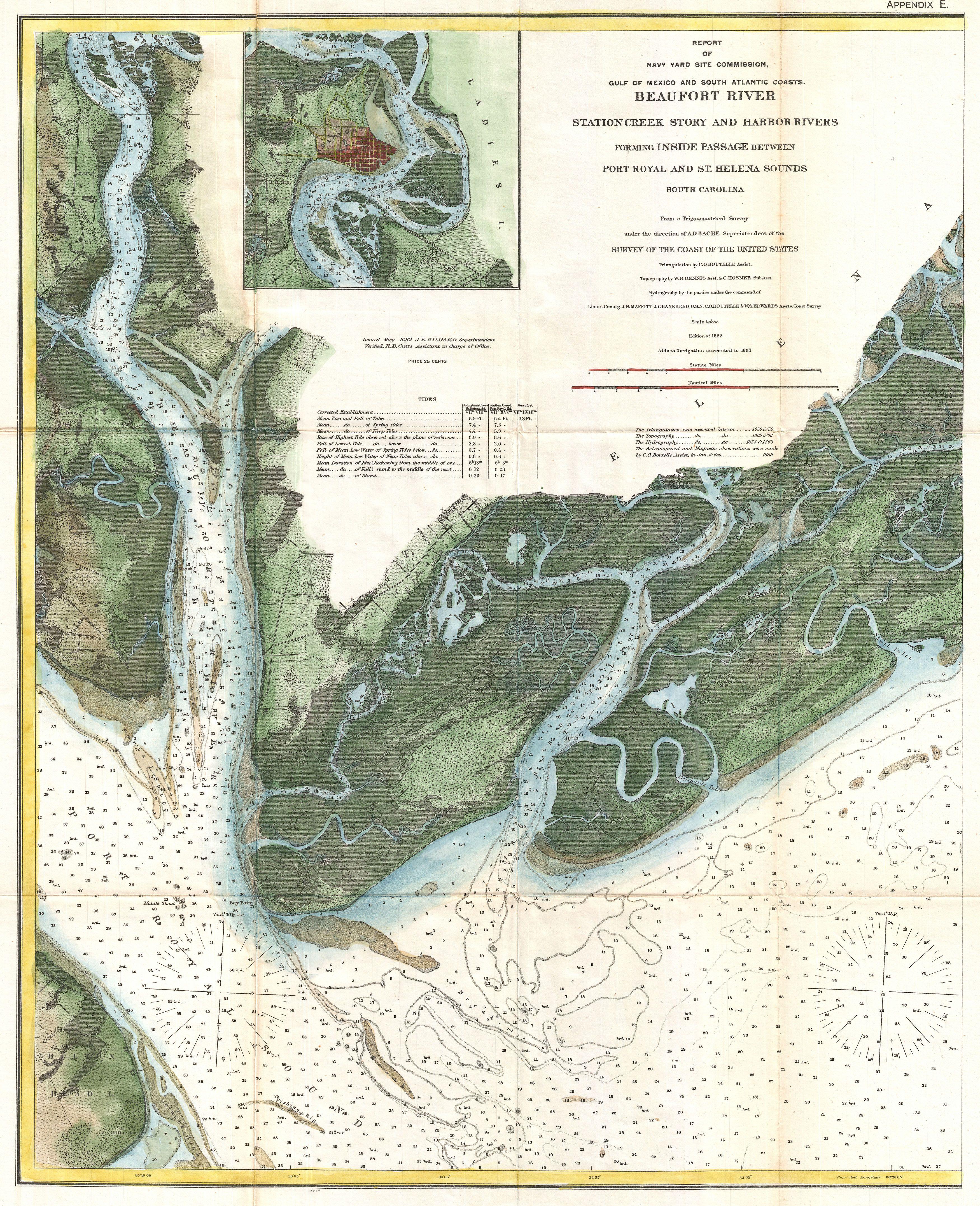
File:1882 U.S. Coast Survey Map of Beaufort, South Carolina - Geographicus - Beaufort-uscs-1882.jpg
Jump to navigation
Jump to search
Size of this preview: 487 × 599 pixels. Other resolutions: 195 × 240 pixels | 390 × 480 pixels | 624 × 768 pixels | 832 × 1,024 pixels | 1,664 × 2,048 pixels | 3,500 × 4,307 pixels.
Original file (3,500 × 4,307 pixels, file size: 3.78 MB, MIME type: image/jpeg)
File history
Click on a date/time to view the file as it appeared at that time.
| Date/Time | Thumbnail | Dimensions | User | Comment | |
|---|---|---|---|---|---|
| current | 00:00, 24 March 2011 | | 3,500 × 4,307 (3.78 MB) | commons>BotMultichillT | {{subst:User:Multichill/Geographicus |link=http://www.geographicus.com/P/AntiqueMap/Beaufort-uscs-1882 |product_name=1882 U.S. Coast Survey Map of Beaufort, South Carolina |map_title=Beaufort River Station Creek Story and Harbor Rivers Forming Inside Pass |
File usage
There are no pages that use this file.