File:1876 1st Essex senate district map Massachusetts.jpg
Jump to navigation
Jump to search

Size of this preview: 800 × 487 pixels. Other resolutions: 320 × 195 pixels | 640 × 390 pixels | 1,024 × 624 pixels | 1,280 × 780 pixels | 3,200 × 1,949 pixels.
Original file (3,200 × 1,949 pixels, file size: 1.09 MB, MIME type: image/jpeg)
File history
Click on a date/time to view the file as it appeared at that time.
| Date/Time | Thumbnail | Dimensions | User | Comment | |
|---|---|---|---|---|---|
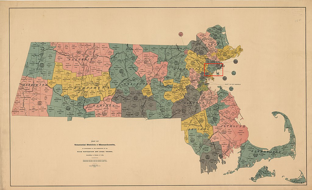
| current | 15:54, 17 April 2020 | | 3,200 × 1,949 (1.09 MB) | commons>M2545 | == {{int:filedesc}} == {{Information |description=Map of districts of the Massachusetts state senate apportioned in 1876. The map includes 1885 population information. The location of the 1st Essex senate district is highlighted in red. Acts and Resolves of the Massachusetts General Court, [https://archives.lib.state.ma.us/handle/2452/89814 1876 Chap. 0190]. An Act To Divide The Commonwealth Into Forty Districts For The Choice Of Senators: "...The city of Lynn and the towns of Nahant, Saugus... |
File usage
There are no pages that use this file.