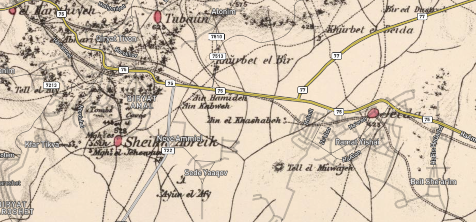
File:1870 map of the area of Sheikh Bureik and Beit She'arim.png
Jump to navigation
Jump to search
Size of this preview: 800 × 373 pixels. Other resolutions: 320 × 149 pixels | 640 × 298 pixels | 1,024 × 477 pixels | 1,840 × 858 pixels.
Original file (1,840 × 858 pixels, file size: 2.43 MB, MIME type: image/png)
File history
Click on a date/time to view the file as it appeared at that time.
| Date/Time | Thumbnail | Dimensions | User | Comment | |
|---|---|---|---|---|---|
| current | 10:27, 29 January 2021 | | 1,840 × 858 (2.43 MB) | commons>Onceinawhile | Uploaded a work by PEF Survey of Palestine and OpenStreetMaps from Palestine Open Maps, with underlying data from PEF Survey of Palestine and OpenStreetMaps with UploadWizard |
File usage
There are no pages that use this file.