File:1855 Colton Map of British North America or Canada - Geographicus - Canada-colton-1855.jpg
Jump to navigation
Jump to search
Size of this preview: 754 × 600 pixels. Other resolutions: 302 × 240 pixels | 603 × 480 pixels | 965 × 768 pixels | 1,280 × 1,019 pixels | 2,560 × 2,037 pixels | 4,000 × 3,183 pixels.
Original file (4,000 × 3,183 pixels, file size: 4.06 MB, MIME type: image/jpeg)
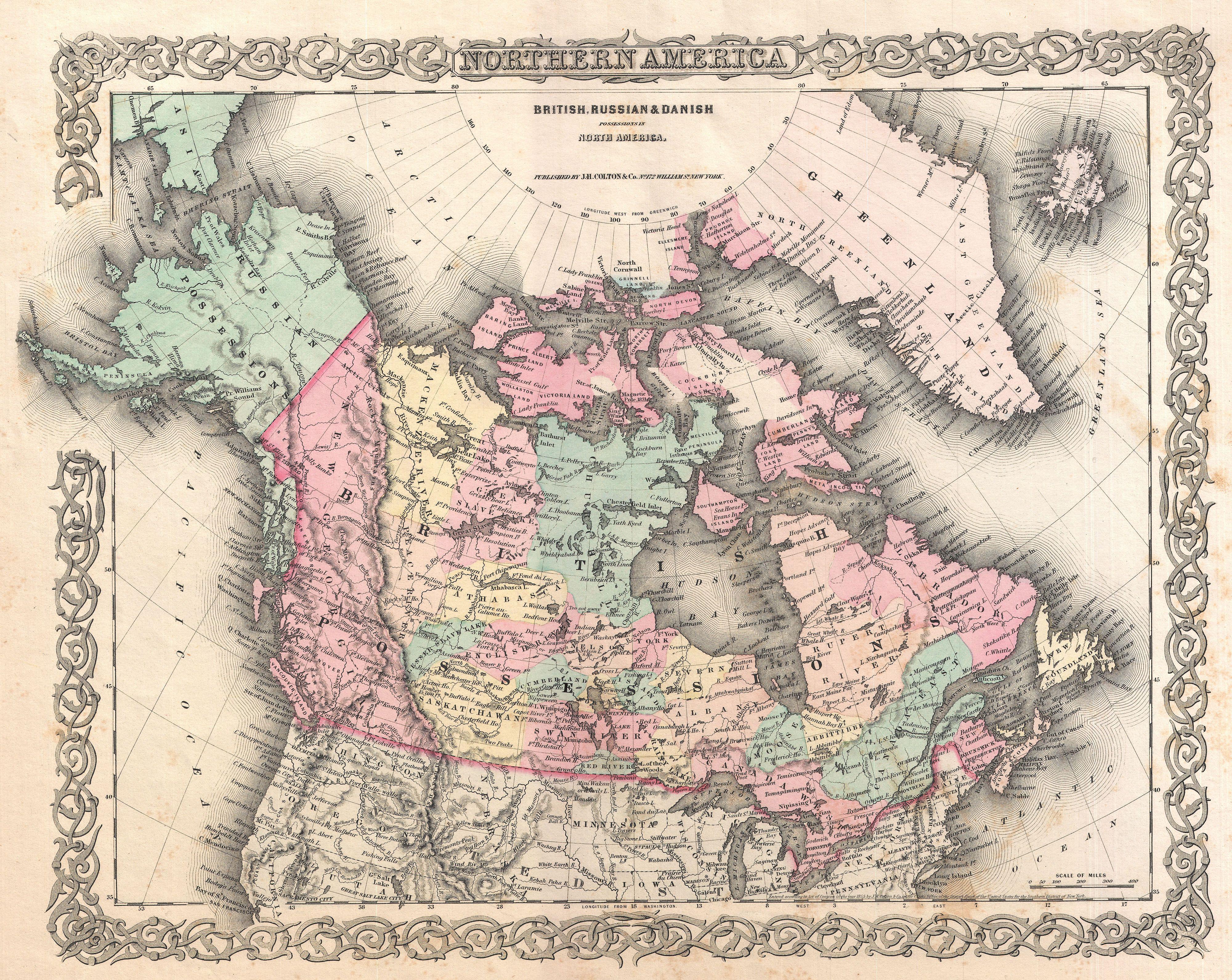
| J. H. Colton: British, Russian and Danish Possessionsin North America.
( |
|||||||||||||||||||||
|---|---|---|---|---|---|---|---|---|---|---|---|---|---|---|---|---|---|---|---|---|---|
| Artist |
|
||||||||||||||||||||
| Title |
British, Russian and Danish Possessionsin North America. |
||||||||||||||||||||
| Description |
English: An excellent first edition example of Colton's rare map documenting Canada, or more specifically, British, Russian, and Danish holdings in North America. Covers the continent from modern day Alaska (Russian America) to Greenland (Danish America), and from the U.S border north to the Arctic. Includes Iceland. Hand colored in pink, green, yellow and blue pastels. Surrounded by Colton's typical spiral motif border. Dated and copyrighted to J. H. Colton, 1855. Published as page no. 3 in volume 1 of the first edition of George Washington Colton's 1855 Atlas of the World . |
||||||||||||||||||||
| Date | 1855 (dated) | ||||||||||||||||||||
| Dimensions | height: 13 in (33 cm); width: 16 in (40.6 cm) | ||||||||||||||||||||
| Accession number |
Geographicus link: Canada-colton-1855 |
||||||||||||||||||||
| Source/Photographer |
Colton, G. W., Colton's Atlas of the World Illustrating Physical and Political Geography, Vol 1, New York, 1855 (First Edition).
|
||||||||||||||||||||
| Permission (Reusing this file) |
|
||||||||||||||||||||

File history
Click on a date/time to view the file as it appeared at that time.
| Date/Time | Thumbnail | Dimensions | User | Comment | |
|---|---|---|---|---|---|
| current | 12:40, 23 March 2011 | | 4,000 × 3,183 (4.06 MB) | commons>BotMultichillT | {{subst:User:Multichill/Geographicus |link=http://www.geographicus.com/P/AntiqueMap/Canada-colton-1855 |product_name=1855 Colton Map of British North America or Canada |map_title=British, Russian and Danish Possessionsin North America. |description=An exc |
File usage
There are no pages that use this file.