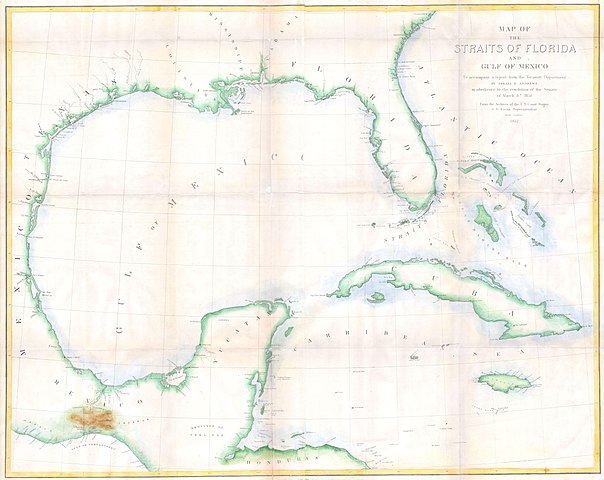
File:1852 Andrews Map of Florida, Cuba and the Gulf of Mexico - Geographicus - StraitsofFlorida-andrews-1852.jpg
Jump to navigation
Jump to search

Size of this preview: 754 × 600 pixels. Other resolutions: 302 × 240 pixels | 604 × 480 pixels | 966 × 768 pixels | 1,280 × 1,018 pixels | 2,560 × 2,036 pixels | 5,000 × 3,977 pixels.
Original file (5,000 × 3,977 pixels, file size: 1.43 MB, MIME type: image/jpeg)
File history
Click on a date/time to view the file as it appeared at that time.
| Date/Time | Thumbnail | Dimensions | User | Comment | |
|---|---|---|---|---|---|
| current | 11:55, 24 March 2011 | | 5,000 × 3,977 (1.43 MB) | commons>BotMultichillT | {{subst:User:Multichill/Geographicus |link=http://www.geographicus.com/P/AntiqueMap/StraitsofFlorida-andrews-1852 |product_name=1852 Andrews Map of Florida, Cuba and the Gulf of Mexico |map_title=Map of the Straits of Florida and Gulf of Mexico. To accom |
File usage
There are no pages that use this file.