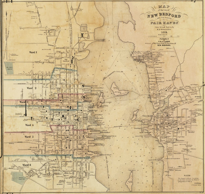
File:1851 map New Bedford Massachusetts by Walling BPL 10676.png
Jump to navigation
Jump to search
Size of this preview: 632 × 600 pixels. Other resolutions: 253 × 240 pixels | 506 × 480 pixels | 709 × 673 pixels.
Original file (709 × 673 pixels, file size: 860 KB, MIME type: image/png)
File history
Click on a date/time to view the file as it appeared at that time.
| Date/Time | Thumbnail | Dimensions | User | Comment | |
|---|---|---|---|---|---|
| current | 12:08, 3 October 2012 | | 709 × 673 (860 KB) | commons>M2545 | {{Information |Description=Map of the City of New Bedford and the Village of Fair Haven, from actual survey by H.F. Walling. Author: Walling, Henry Francis Publisher: C. & A. Taber (Firm) Date: 1851 Location: Bristol County (Mass.), New Bedford (Ma... |
File usage
There are no pages that use this file.