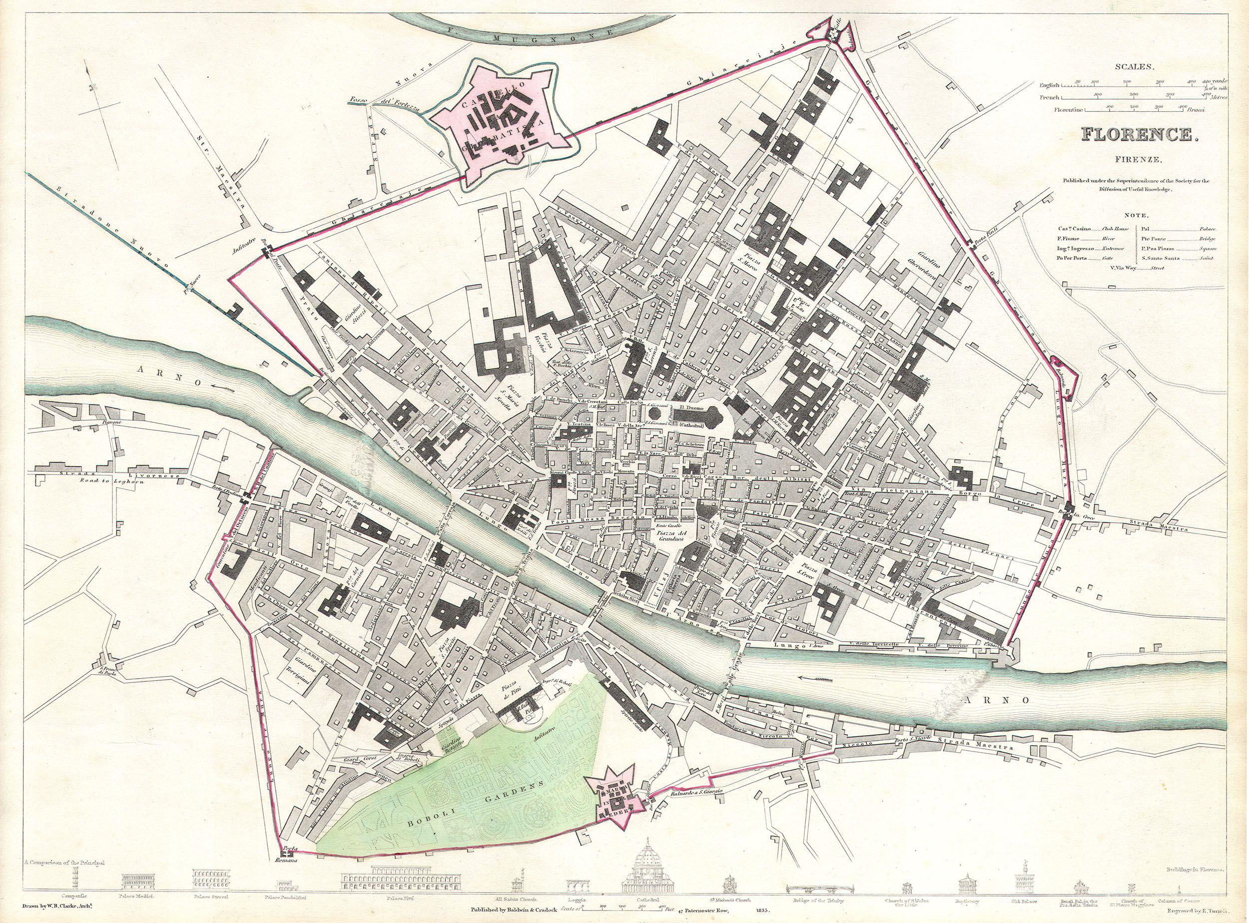
File:1835 S.D.U.K. City Map or Plan of Florence or Firenze, Italy - Geographicus - Florence-SDUK-1835.jpg
Jump to navigation
Jump to search
Size of this preview: 800 × 591 pixels. Other resolutions: 320 × 237 pixels | 640 × 473 pixels | 1,024 × 757 pixels | 1,280 × 946 pixels | 2,500 × 1,848 pixels.
Original file (2,500 × 1,848 pixels, file size: 1 MB, MIME type: image/jpeg)
File history
Click on a date/time to view the file as it appeared at that time.
| Date/Time | Thumbnail | Dimensions | User | Comment | |
|---|---|---|---|---|---|
| current | 18:52, 24 March 2011 | | 2,500 × 1,848 (1 MB) | commons>BotMultichillT | {{subst:User:Multichill/Geographicus |link=http://www.geographicus.com/P/AntiqueMap/Florence-SDUK-1835 |product_name=1835 S.D.U.K. City Map or Plan of Florence or Firenze, Italy |map_title=Florence. Firenze. |description=This map is a steel plate engravin |
File usage
There are no pages that use this file.