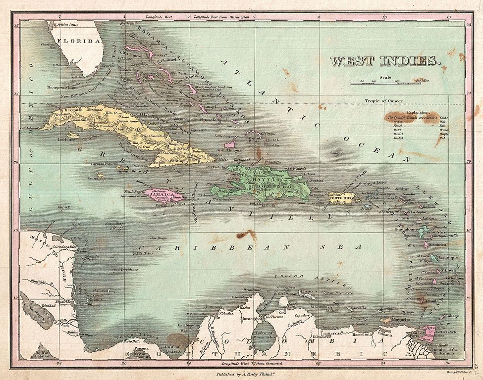
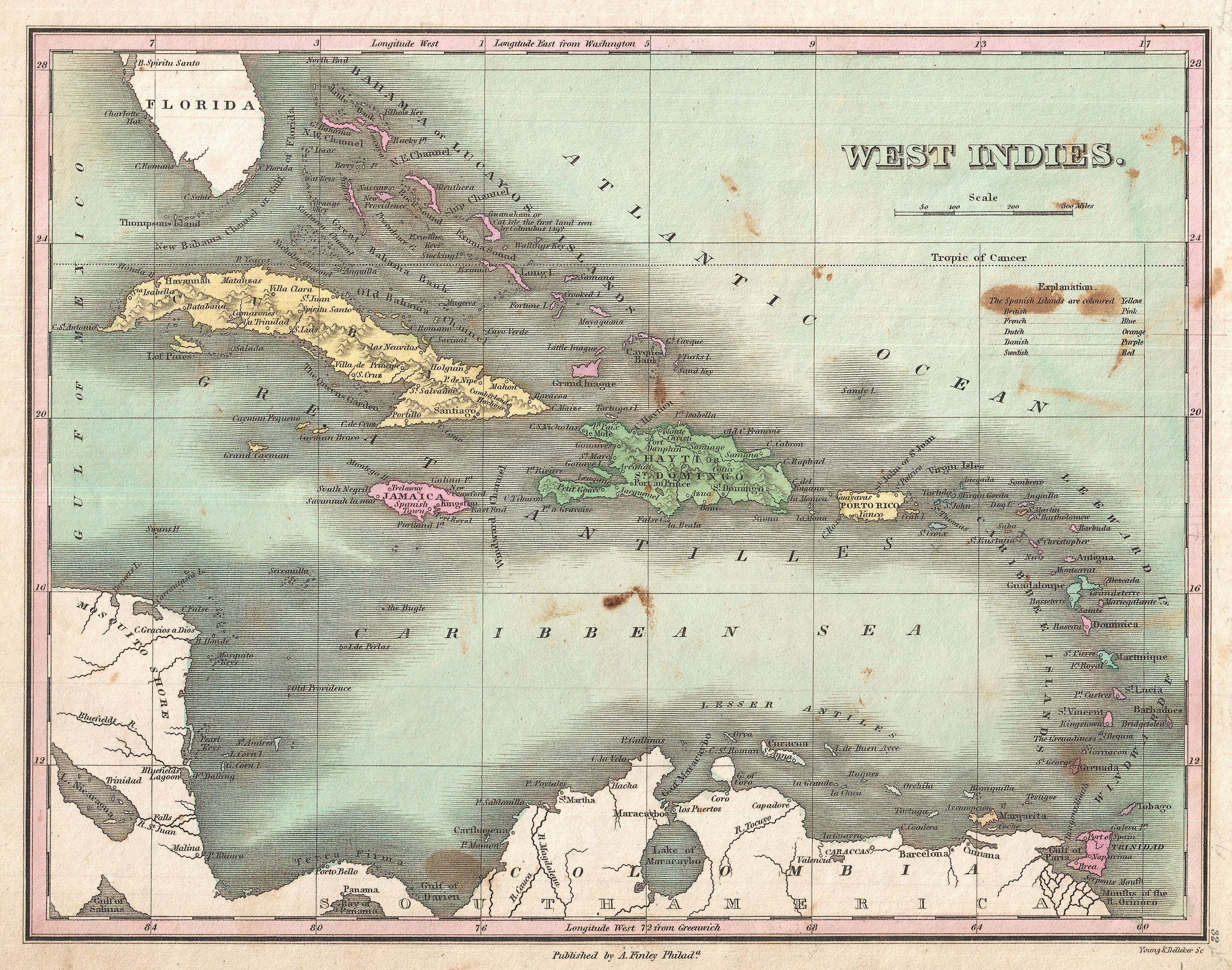
File:1827 Finley Map of the West Indies, Caribbean, and Antilles - Geographicus - WestIndies-finley-1827.jpg
Jump to navigation
Jump to search

Size of this preview: 761 × 600 pixels. Other resolutions: 305 × 240 pixels | 609 × 480 pixels | 975 × 768 pixels | 1,280 × 1,009 pixels | 2,560 × 2,017 pixels | 3,000 × 2,364 pixels.
Original file (3,000 × 2,364 pixels, file size: 2.12 MB, MIME type: image/jpeg)
File history
Click on a date/time to view the file as it appeared at that time.
| Date/Time | Thumbnail | Dimensions | User | Comment | |
|---|---|---|---|---|---|
| current | 09:17, 23 March 2011 | | 3,000 × 2,364 (2.12 MB) | commons>BotMultichillT | {{subst:User:Multichill/Geographicus |link=http://www.geographicus.com/P/AntiqueMap/WestIndies-finley-1827 |product_name=1827 Finley Map of the West Indies, Caribbean, and Antilles |map_title=West Indies. |description=This is Finley’s desirable 1827 map |
File usage
There are no pages that use this file.