File:1820 Salem Massachusetts map bySaunders BPL 12094.png
Jump to navigation
Jump to search

Size of this preview: 800 × 541 pixels. Other resolutions: 320 × 216 pixels | 640 × 433 pixels | 1,052 × 711 pixels.
Original file (1,052 × 711 pixels, file size: 1.2 MB, MIME type: image/png)
File history
Click on a date/time to view the file as it appeared at that time.
| Date/Time | Thumbnail | Dimensions | User | Comment | |
|---|---|---|---|---|---|
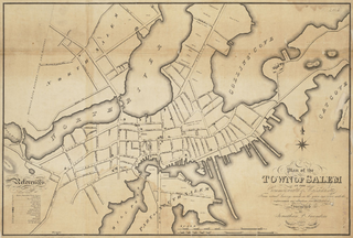
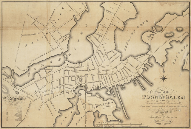
| current | 15:39, 15 February 2011 | | 1,052 × 711 (1.2 MB) | commons>M2545 | {{Information |Description=Plan of the town of Salem in the commonwealth of Massachusetts, from actual surveys, made in the years 1796 & 1804; with the improvements and alterations since that period as surveyed |Source=http://maps.bpl.org/details_12094 |D |
File usage
There are no pages that use this file.