Portal:Tropical cyclones
The Tropical Cyclones Portal
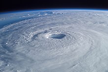
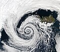
A tropical cyclone is a storm system characterized by a large low-pressure center, a closed low-level circulation and a spiral arrangement of numerous thunderstorms that produce strong winds and heavy rainfall. Tropical cyclones feed on the heat released when moist air rises, resulting in condensation of water vapor contained in the moist air. They are fueled by a different heat mechanism than other cyclonic windstorms such as Nor'easters, European windstorms and polar lows, leading to their classification as "warm core" storm systems. Most tropical cyclones originate in the doldrums, approximately ten degrees from the Equator.
The term "tropical" refers to both the geographic origin of these systems, which form almost exclusively in tropical regions of the globe, as well as to their formation in maritime tropical air masses. The term "cyclone" refers to such storms' cyclonic nature, with anticlockwise rotation in the Northern Hemisphere and clockwise rotation in the Southern Hemisphere. Depending on its location and intensity, a tropical cyclone may be referred to by names such as "hurricane", "typhoon", "tropical storm", "cyclonic storm", "tropical depression" or simply "cyclone".
Types of cyclone: 1. A "Typhoon" is a tropical cyclone located in the North-west Pacific Ocean which has the most cyclonic activity and storms occur year-round. 2. A "Hurricane" is also a tropical cyclone located at the North Atlantic Ocean or North-east Pacific Ocean which have an average storm activity and storms typically form between May 15 and November 30. 3. A "Cyclone" is a tropical cyclone that occurs in the South Pacific and Indian Oceans.
Selected named cyclone -
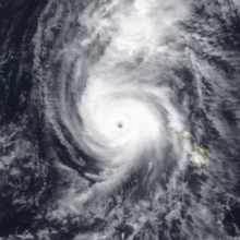
Hurricane Iniki (/iːˈniːkiː/ ee-NEE-kee; Hawaiian: ʻiniki meaning "strong and piercing wind") was a hurricane that struck the island of Kauaʻi on September 11, 1992. It was the most powerful hurricane to strike Hawaiʻi in recorded history, and the only hurricane to directly affect the state during the 1992 Pacific hurricane season. Forming on September 5, 1992, during the strong 1990–1995 El Niño, Iniki was one of eleven Central Pacific tropical cyclones during that season. It attained tropical storm status on September 8 and intensified into a hurricane the next day. After abruptly turning north, Iniki struck Kauaʻi at peak intensity; it had winds of 145 mph and reached Category 4 status on the Saffir–Simpson hurricane scale.
Winds gusted to 225 mph (362 km/h). It was the first hurricane to hit the state since Hurricane Iwa in the 1982 season, and the only known major hurricane to hit the state. Iniki dissipated on September 13, about halfway between Hawaii and Alaska. (Full article...)Selected article -
Selected image -
Selected season -

The 2017 Pacific hurricane season was an above average Pacific hurricane season in terms of named storms, though less active than the previous three, featuring eighteen named storms, nine hurricanes, and four major hurricanes. Despite the considerable amount of activity, most of the storms were weak and short-lived. The season officially started on May 15 in the eastern Pacific Ocean, and on June 1 in the central Pacific; they both ended on November 30. These dates conventionally delimit the period of each year when most tropical cyclones form in the respective regions. However, the formation of tropical cyclones is possible at any time of the year, as illustrated in 2017 by the formation of the season's first named storm, Tropical Storm Adrian, on May 9. At the time, this was the earliest formation of a tropical storm on record in the eastern Pacific basin proper (east of 140°W). The season saw near-average activity in terms of accumulated cyclone energy (ACE), in stark contrast to the extremely active seasons in 2014, 2015, and 2016; and for the first time since 2012, no tropical cyclones formed in the Central Pacific basin. However, for the third year in a row, the season featured above-average activity in July, with the ACE value being the fifth highest for the month. Damage across the basin reached $375.28 million (2017 USD), while 45 people were killed by the various storms.
Prior to the start of this season, the National Hurricane Center (NHC) changed its policy to permit issuance of advisories on disturbances that were not yet tropical cyclones but had a high chance to become one, and were expected to bring tropical storm or hurricane conditions to landmasses within 48 hours. As a result of this change, watches and warnings could be issued by local authorities. Such systems would be termed as "Potential Tropical Cyclones". The first system to receive this designation was Potential Tropical Cyclone Fourteen-E, which developed into Tropical Storm Lidia south-southeast of the Baja California Peninsula on August 30.
(Full article...)Related portals
Currently active tropical cyclones

Italicized basins are unofficial.
- North Atlantic (2024)
- No active systems
- East and Central Pacific (2024)
- No active systems
- West Pacific (2024)
- No active systems
- North Indian Ocean (2024)
- No active systems
- Mediterranean (2023–24)
- No active systems
- South-West Indian Ocean (2023–24)
- No active systems
- Australian region (2023–24)
- No active systems
- South Pacific (2023–24)
- No active systems
- South Atlantic (2023–24)
- No active systems
Last updated: 21:50, 2 June 2024 (UTC)
Tropical cyclone anniversaries

June 12,
- 1997 - Cyclone Keli, the first post-season tropical cyclone to form in June, reaches peak strength while affecting the Pacific Islands.
- 2004 - Tropical Storm Chanthu (pictured) made landfall in Vietnam, killing seven people. Chanthu caused over 230 mm (9.4 in) of rain.
- 2014 - Hurricane Cristina reaches peak intensity as a Category 4 major hurricane.

June 13,
- 1977 - The 1977 Oman cyclone makes landfall over in eastern Oman killing 105 people in total.
- 2006 - Tropical Storm Alberto made landfall on the Florida Panhandle as a strong tropical storm. Alberto brought heavy rain to the southeastern United States, causing about $500,000 in damage.
- 2015 - Hurricane Carlos (pictured) reaches its peak strength off the coast of Southwestern Mexico, causing about $1 million in damages.

June 14,
- 1904 - The first storm of the 1904 Atlantic hurricane season made landfall in eastern Cuba, killing at least 87 people.
- 1991 - Typhoon Yunya (pictured) reaches Category 3 typhoon intensity prior to making landfall in Luzon in the Philippines the same day as Mount Pinatubo made its largest eruption. The rainfall from the typhoon mixed with the volcanic ash, causing severe lahars.
Did you know…
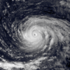


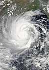
- …that the Joint Typhoon Warning Center considers that Typhoon Vera (pictured) of 1986 is actually two distinct systems, formed from two separated low-level circulations?
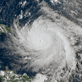
- …that Hurricane Agatha (pictured) was the strongest Pacific hurricane to make landfall in Mexico in May since records began in 1949?
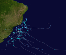
- …that Cyclone Raquel (track pictured) travelled between the Australian and South Pacific basins between the 2014–15 and 2015–16 seasons, spanning both seasons in both basins?
- …that Cyclone Amphan (pictured) in 2020 was the first storm to be classified as a Super Cyclonic Storm in the Bay of Bengal since 1999?
General images -

The following is a list of tropical cyclones that affected the U.S. state of Delaware. Since reliable records began, no tropical cyclone has struck the state while maintaining hurricane intensity, and only two storms since 1851 caused hurricane-force winds in the state.
- October 21, 1749 – A hurricane impacted the Mid-Atlantic, and impacts were observed in Delaware, but it's unclear at what strength the storm was when it impacted the state.
- Fall, 1783 – Nine large ships crash near Cape Henlopen during a gale, killing several people.
- September 2, 1785 – A hurricane causes 181 deaths in the state. Whether or not it made landfall is unknown.
- September 3–5, 1815 – A tropical storm passes over extreme southeastern Delaware. Effects, if any, are unknown.
- September 3, 1821 – The eye of the Norfolk and Long Island Hurricane moves directly over Cape Henlopen for 30 minutes.
- August 17, 1830 – A hurricane that passes to the east of the state capsizes three ships along the Delaware capes. (Full article...)
Topics
Subcategories
Related WikiProjects
WikiProject Tropical cyclones is the central point of coordination for Wikipedia's coverage of tropical cyclones. Feel free to help!
WikiProject Weather is the main center point of coordination for Wikipedia's coverage of meteorology in general, and the parent project of WikiProject Tropical cyclones. Three other branches of WikiProject Weather in particular share significant overlaps with WikiProject Tropical cyclones:
- The Non-tropical storms task force coordinates most of Wikipedia's coverage on extratropical cyclones, which tropical cyclones often transition into near the end of their lifespan.
- The Floods task force takes on the scope of flooding events all over the world, with rainfall from tropical cyclones a significant factor in many of them.
- WikiProject Severe weather documents the effects of extreme weather such as tornadoes, which landfalling tropical cyclones can produce.
Things you can do
 |
Here are some tasks awaiting attention:
|
Wikimedia
The following Wikimedia Foundation sister projects provide more on this subject:
-
Commons
Free media repository -
Wikibooks
Free textbooks and manuals -
Wikidata
Free knowledge base -
Wikinews
Free-content news -
Wikiquote
Collection of quotations -
Wikisource
Free-content library -
Wikiversity
Free learning tools -
Wikivoyage
Free travel guide -
Wiktionary
Dictionary and thesaurus
- Manually maintained portal pages from June 2018
- All manually maintained portal pages
- Portals with triaged subpages from June 2018
- All portals with triaged subpages
- All portals
- Portals with named maintainer
- Random portal component with 31–40 available image subpages
- Tropical cyclones portal
- Physical science portals
- Tropical cyclones
- Redirect targets of redirected portals with existing subpages
- WikiProject Tropical cyclones
