Park Gate
This article has multiple issues. Please help improve it or discuss these issues on the talk page. (Learn how and when to remove these template messages)
|
| Park Gate | |
|---|---|
 Park Gate Location within Hampshire | |
| Area | 1.139 sq mi (2.95 km2) |
| Population | 7,811 |
| • Density | 6,858/sq mi (2,648/km2) |
| OS grid reference | SU5108 |
| District | |
| Shire county | |
| Region | |
| Country | England |
| Sovereign state | United Kingdom |
| Post town | Southampton |
| Postcode district | SO31 |
| Dialling code | 01489 |
| Police | Hampshire and Isle of Wight |
| Fire | Hampshire and Isle of Wight |
| Ambulance | South Central |
| UK Parliament | |
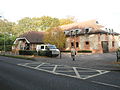
Park Gate is a village and civil parish in the Borough of Fareham[1] in Hampshire, England. It borders Locks Heath to the south, Segensworth to the east and Sarisbury to the west. Park Gate has two churches, Duncan Road Church and St Margaret Mary R.C. It also has three takeaway shops.[2]
History
Park Gate was developed around Swanwick railway station and was a distribution hub for local strawberries that were grown in the area. In 1913, at the peak of strawberry production, more than 3,000 tons of strawberries were sent from local fields every week to be distributed from the station. Strawberry distribution stopped in 1966, however, the railway station remains, and even though fruit and vegetables are still grown in the area, the present landscape is dominated by housing. The Station Master's House adjacent to the railway station has since become a restaurant.
In 1944, Park Gate played host to convoys of Canadian soldiers and tanks who were stationed along Botley Road adjacent to Fair View Terrace, waiting for their orders for the Normandy D-Day landings. During this time, there was an account of a V1 rocket landing in the Duncan Road area, causing some of the Canadian ammunition trucks to catch fire and explode.
In the late 1980s, Park Gate along with neighbouring Locks Heath, became a growth sector for southern Hampshire with modern businesses moving to nearby Segensworth. With Junction 9 of the M27 within easy reach, Park Gate has become a base for commuting East to Portsmouth, West to Southampton and North to Winchester, Andover and Basingstoke.
Gallery
-
 St Margaret Mary R.C. Church, Middle Road
 -
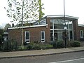
 Park Gate Police Station
 -
 Park Gate Primary School


See also
Notes
- ^ local councillors Archived 2007-10-18 at the Wayback Machine
- ^ St Margaret Church website
External links
This Hampshire location article is a stub. You can help Wikipedia by expanding it. |
- Pages using gadget WikiMiniAtlas
- Webarchive template wayback links
- Articles needing additional references from May 2023
- All articles needing additional references
- Articles that may contain original research from May 2023
- All articles that may contain original research
- Articles with multiple maintenance issues
- Use dmy dates from October 2019
- Articles with short description
- Short description is different from Wikidata
- Articles with OS grid coordinates
- Coordinates on Wikidata
- Villages in Hampshire
- All stub articles
- Hampshire geography stubs