Ortaçalı, Elâzığ
Jump to navigation
Jump to search
Ortaçalı | |
|---|---|
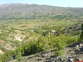
 The landscape around Ortaçalı | |
| Coordinates: 38°27′50″N 39°01′54″E / 38.46389°N 39.03167°E | |
| Country | Turkey |
| Province | Elazığ |
| District | Elazığ |
| Population (2021) | 176 |
| Time zone | UTC+3 (TRT) |


Ortaçalı is a village of Elazığ District in Elazığ Province eastern Turkey.[2] Its population is 176 (2021).[3] The village is populated by Kurds of the Parçikan tribe.[4]
Earthquakes
In 2007 an earthquake of magnitude 3.5 occurred on Sunday, February 25, 2007, centered on the town.[5]
Ortaçalı was also strongly impacted by the 2020 Elazığ earthquake.
References
- ^ Ortaçalı Köyü.
- ^ Köy, Turkey Civil Administration Departments Inventory. Retrieved 21 December 2022.
- ^ "Address-based population registration system (ADNKS) results dated 31 December 2021" (XLS) (in Turkish). TÜİK. Retrieved 21 December 2022.
- ^ Çakar, Enver (2012). "Aşiretlerin yerleşim alanları" [Settlement of the tribes] (Map). Elazığ Baskil Yöresi Aşiretleri (in Turkish). Ertem Basım.
- ^ Earthquake 1.85km (1.15 miles) away from Ortaçalı (Turkey).
