Natividade, Tocantins
Jump to navigation
Jump to search
Natividade | |
|---|---|
 | |
| Coordinates: 11°42′35″S 47°43′24″W / 11.70972°S 47.72333°W | |
| Country | Brazil |
| Region | North |
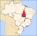
| State | Tocantins |
| Area | |
| • Total | 3,240 km2 (1,250 sq mi) |
| Elevation | 323 m (1,060 ft) |
| Population (2020 [1]) | |
| • Total | 9,250 |
| • Density | 2.9/km2 (7.4/sq mi) |
| Time zone | UTC−3 (BRT) |
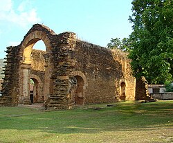
Natividade (meaning the nativity) is a municipality (município) in the state of Tocantins in Brazil.
Geography
The estimated population in 2020 was 9,250, the area is 3,240 km2. The elevation is 323 m.[2]
Commemoration
The Roman Catholic commemoration of Senhor do Bonfim is the most traditional in the state of Tocantins.[3]
References
- ^ "IBGE 2020". Retrieved 26 January 2021.
- ^ "IBGE | Cidades | Tocantins | Natividade". cidades.ibge.gov.br. Retrieved 2016-05-16.
- ^ "Fé e tradição marcam Romaria do Senhor do Bonfim, maior evento religioso do Tocantins". www.to.gov.br (in Brazilian Portuguese). Retrieved 2023-05-15.
Categories:
- Pages using gadget WikiMiniAtlas
- CS1 Brazilian Portuguese-language sources (pt-br)
- Articles with short description
- Short description is different from Wikidata
- Coordinates on Wikidata
- Articles with VIAF identifiers
- Articles with J9U identifiers
- Articles with LCCN identifiers
- Municipalities in Tocantins
- All stub articles
- Tocantins geography stubs


