File:USGS Community Internet Intensity Map 30 May 2015 Bonin Islands Earthquake M 7.8.pdf
Jump to navigation
Jump to search
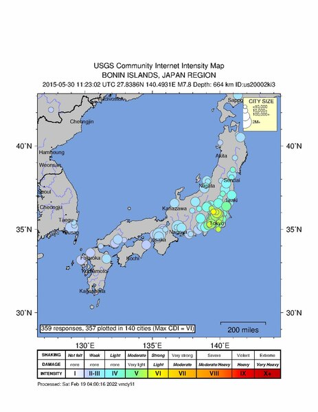
Size of this JPG preview of this PDF file: 463 × 599 pixels. Other resolutions: 185 × 240 pixels | 371 × 480 pixels | 593 × 768 pixels | 1,275 × 1,650 pixels.
Original file (1,275 × 1,650 pixels, file size: 122 KB, MIME type: application/pdf)
File history
Click on a date/time to view the file as it appeared at that time.
| Date/Time | Thumbnail | Dimensions | User | Comment | |
|---|---|---|---|---|---|
| current | 05:06, 2 January 2024 |  | 1,275 × 1,650 (122 KB) | commons>Sapiann | Uploaded a work by United States Geological Survey from United States Geological Survey with UploadWizard |
File usage
There are no pages that use this file.