File:Occupation borders in Slovenia 1941-1945. Border lines and occupied territories.tif
Jump to navigation
Jump to search

Size of this JPG preview of this TIF file: 800 × 565 pixels. Other resolutions: 320 × 226 pixels | 640 × 452 pixels | 1,024 × 723 pixels | 1,280 × 904 pixels | 2,560 × 1,808 pixels | 3,094 × 2,185 pixels.
Original file (3,094 × 2,185 pixels, file size: 19.34 MB, MIME type: image/tiff)
File history
Click on a date/time to view the file as it appeared at that time.
| Date/Time | Thumbnail | Dimensions | User | Comment | |
|---|---|---|---|---|---|
| current | 10:07, 29 May 2023 | 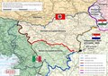 | 3,094 × 2,185 (19.34 MB) | commons>Bb63lj | Uploaded a work by Manca Volk Bahun, Rok Ciglič, Matija Zorn from The map is the result of work on the research project Make me this German-Italian-Hungarian-Croatian country! The role of occupation borders in denationalization policy and the life of the Slovenian population. (Funded by ARRS J6-8248). The project was implemented by Kornelija Ajlec, Bojan Balkovec, Rok Ciglič, Božidar Flajšman, Aleš Gabrič, Primož Gašperič, Bojan Godeša, Darja Kerec, Attila Kovacs, Peter Mikša, Božo Repe (mana... |
File usage
There are no pages that use this file.