File:OLD TIOGA ROAD VIEW, NOW MAY LAKE ROAD. LOOKING SW. GIS- N-37 49 16.8 - W-119 30 13.3 - Tioga Road, Between Crane Flat and Tioga Pass, Yosemite Village, Mariposa County, CA HAER CAL,22-YOSEM,6-25.tif
Jump to navigation
Jump to search

Size of this JPG preview of this TIF file: 734 × 599 pixels. Other resolutions: 294 × 240 pixels | 588 × 480 pixels | 941 × 768 pixels | 1,254 × 1,024 pixels | 2,508 × 2,048 pixels | 5,159 × 4,213 pixels.
Original file (5,159 × 4,213 pixels, file size: 20.73 MB, MIME type: image/tiff)
File history
Click on a date/time to view the file as it appeared at that time.
| Date/Time | Thumbnail | Dimensions | User | Comment | |
|---|---|---|---|---|---|
| current | 06:59, 5 July 2014 | 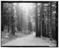 | 5,159 × 4,213 (20.73 MB) | commons>Fæ | GWToolset: Creating mediafile for Fæ. HABS batch upload 2 July 2014 (301:400) |
File usage
There are no pages that use this file.