Erstein
Jump to navigation
Jump to search
You can help expand this article with text translated from the corresponding article in French. (December 2008) Click [show] for important translation instructions.
|
Erstein
Eerstain | |
|---|---|
 The town hall in Erstein | |
 Coat of arms | |
Location of Erstein  | |
 Erstein  Erstein | |
| Coordinates: 48°25′N 7°40′E / 48.42°N 7.66°E | |
| Country | France |
| Region | Grand Est |
| Department | Bas-Rhin |
| Arrondissement | Sélestat-Erstein |
| Canton | Erstein |
| Intercommunality | CC Canton d'Erstein |
| Government | |
| • Mayor (2022–2026) | Benoît Dintrich[1] |
| Area 1 | 36.22 km2 (13.98 sq mi) |
| Population (2021)[2] | 10,887 |
| • Density | 300/km2 (780/sq mi) |
| Time zone | UTC+01:00 (CET) |
| • Summer (DST) | UTC+02:00 (CEST) |
| INSEE/Postal code | 67130 /67150 |
| Elevation | 147–157 m (482–515 ft) (avg. 150 m or 490 ft) |
| 1 French Land Register data, which excludes lakes, ponds, glaciers > 1 km2 (0.386 sq mi or 247 acres) and river estuaries. | |
Erstein (German pronunciation: [ɛɐ̯ˈʃtaɪ̯n], French: [ɛʁʃtajn] ; Alemannic: Eerstain) is a commune in the Bas-Rhin department, in the region of Grand Est, France.[3]
History
An important necropolis from the Merovingian era (6th-7th century) has been excavated near Erstein in 1999–2000.[4]
Erstein was known in Alsace in the Middle Age for its canonesses monastery, founded in the 9th century and abandoned in 1422. The buildings were destroyed in the 16th and 19th centuries.[5]
Demographics
|
| ||||||||||||||||||||||||||||||||||||||||||||||||||||||||||||||||||||||||||||||||||||||||||||||||||||||||||||||||||
| |||||||||||||||||||||||||||||||||||||||||||||||||||||||||||||||||||||||||||||||||||||||||||||||||||||||||||||||||||
| Source: EHESS[6] and INSEE (1968-2017)[7] | |||||||||||||||||||||||||||||||||||||||||||||||||||||||||||||||||||||||||||||||||||||||||||||||||||||||||||||||||||
Twin towns
-
 Erstein Street
 -
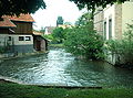 Near Ill River
 -
 Calvaire (1746)
 -
 Old Factory


People
- Laure Diebold, (1915–1965), Compagnon de la Libération, was born in Erstein
- François-Joseph d'Offenstein (1760–1837) French general, was born in Erstein
See also
References
- ^ "Répertoire national des élus: les maires" (in French). data.gouv.fr, Plateforme ouverte des données publiques françaises. 13 September 2022.
- ^ "Populations légales 2021" (in French). The National Institute of Statistics and Economic Studies. 28 December 2023.
- ^ INSEE commune file
- ^ Médard, Fabienne (2006). "La nécropole mérovingienne d'Erstein (Bas-Rhin) : étude des textiles minéralisés au contact des fibules". Revue archéologique de l'Est. 55.
- ^ Base Mérimée: Abbaye de chanoinesses Sainte-Cécile, Saint-Sixte, Ministère français de la Culture. (in French)
- ^ Des villages de Cassini aux communes d'aujourd'hui: Commune data sheet Erstein, EHESS (in French).
- ^ Population en historique depuis 1968, INSEE
Wikimedia Commons has media related to Erstein.
| International | |
|---|---|
| National | |
| Geographic | |
This Bas-Rhin geographical article is a stub. You can help Wikipedia by expanding it. |
Categories:
- Pages using gadget WikiMiniAtlas
- Pages using the Phonos extension
- Pages using the Graph extension
- Pages with disabled graphs
- CS1 French-language sources (fr)
- Articles with French-language sources (fr)
- Geography articles needing translation from French Wikipedia
- Articles with short description
- Short description is different from Wikidata
- Coordinates on Wikidata
- Pages using infobox settlement with image map1 but not image map
- Pages with German IPA
- Pages with French IPA
- Pages including recorded pronunciations
- Articles containing Alemannic German-language text
- Commons category link from Wikidata
- Articles with VIAF identifiers
- Articles with BNF identifiers
- Articles with BNFdata identifiers
- Articles with GND identifiers
- Articles with J9U identifiers
- Articles with LCCN identifiers
- Articles with MusicBrainz area identifiers
- Communes of Bas-Rhin
- Bas-Rhin communes articles needing translation from French Wikipedia
- All stub articles
- Bas-Rhin geography stubs
- Pages using the Kartographer extension