Cunningham Corner, Arkansas
Jump to navigation
Jump to search
Cunningham Corner | |
|---|---|
 Cunningham Corner Cunningham Corner's position in Arkansas. | |
| Coordinates: 35°11′30″N 90°17′30″W / 35.19167°N 90.29167°W | |
| Country | United States |
| State | Arkansas |
| County | Crittenden |
| Township | Jackson |
| Elevation | 217 ft (66 m) |
| Time zone | UTC-6 (Central (CST)) |
| • Summer (DST) | UTC-5 (CDT) |
| Area code | 870 |
| GNIS feature ID | 67798[1] |
Cunningham Corner (formerly Cunningham's Corner) is an unincorporated community in Jackson Township, Crittenden County, Arkansas, United States.[1] It is located at the intersection of Highway 147 and Highway 128 approximately six miles west-northwest of West Memphis.[2]
References
- ^ a b c U.S. Geological Survey Geographic Names Information System: Cunningham Corner, Arkansas
- ^ Arkansas Atlas and Gazetteer, DeLorme, 2nd ed., 2004, p. 45 ISBN 0899333451
Municipalities and communities of Crittenden County, Arkansas, United States | ||
|---|---|---|
| Cities | 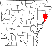 | |
| Towns | ||
| Unincorporated communities | ||
This article about a location in Crittenden County, Arkansas is a stub. You can help Wikipedia by expanding it. |
Categories:
- Pages using gadget WikiMiniAtlas
- Use mdy dates from July 2023
- Articles with short description
- Short description is different from Wikidata
- Coordinates on Wikidata
- Unincorporated communities in Crittenden County, Arkansas
- Unincorporated communities in Arkansas
- All stub articles
- Upper Delta Arkansas geography stubs