Culverton, Georgia
Jump to navigation
Jump to search
Culverton, Georgia | |
|---|---|
 Culverton  Culverton | |
| Coordinates: 33°18′31″N 82°53′43″W / 33.30861°N 82.89528°W | |
| Country | United States |
| State | Georgia |
| County | Hancock |
| Elevation | 554 ft (169 m) |
| Time zone | UTC-5 (Eastern (EST)) |
| • Summer (DST) | UTC-4 (EDT) |
| GNIS feature ID | 355405 |
Culverton (also Mount Carmel) is an unincorporated community in Hancock County, Georgia, United States. It lies along State Route 16 to the east of the city of Sparta, the county seat of Hancock County.[1] Its elevation is 554 feet (169 m).[2] The community is part of the Milledgeville Micropolitan Statistical Area.
Culverton was named after Hardy Culver, an early resident.[3]
See also
References
- ^ Rand McNally. The Road Atlas '05. Skokie: Rand McNally, 2005, p. 28.
- ^ U.S. Geological Survey Geographic Names Information System: Culverton, Georgia, Geographic Names Information System, 1979-09-25. Accessed 2007-12-23.
- ^ Krakow, Kenneth K. (1975). Georgia Place-Names: Their History and Origins (PDF). Macon, GA: Winship Press. p. 55. ISBN 0-915430-00-2.
Municipalities and communities of Hancock County, Georgia, United States | ||
|---|---|---|
| City | 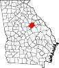 | |
| Unincorporated communities | ||
This Hancock County, Georgia state location article is a stub. You can help Wikipedia by expanding it. |
Categories:
- Pages using gadget WikiMiniAtlas
- Use mdy dates from July 2023
- Articles with short description
- Short description is different from Wikidata
- Coordinates on Wikidata
- Unincorporated communities in Hancock County, Georgia
- Unincorporated communities in Georgia (U.S. state)
- Milledgeville micropolitan area, Georgia
- All stub articles
- Central Savannah River Area geography stubs