Chaseley, North Dakota
Jump to navigation
Jump to search
Chaseley | |
|---|---|
 Church in Chaseley | |
 Chaseley Location within the state of North Dakota  Chaseley Chaseley (the United States) | |
| Coordinates: 47°27′01″N 99°49′12″W / 47.45028°N 99.82000°W | |
| Country | United States |
| State | North Dakota |
| County | Wells |
| Elevation | 1,867 ft (569 m) |
| Time zone | UTC-6 (Central (CST)) |
| • Summer (DST) | UTC-5 (CDT) |
| ZIP codes | 58423 |
| Area code | 701 |
| GNIS feature ID | 1028349[1] |
Chaseley is an unincorporated community in southwestern Wells County, North Dakota, United States. It lies along North Dakota Highway 200 southwest of the city of Fessenden, the county seat of Wells County.[2] It formerly had a post office, with the ZIP code of 58423.[3]
References
- ^ a b U.S. Geological Survey Geographic Names Information System: Chaseley, North Dakota
- ^ Rand McNally. The Road Atlas '08. Chicago: Rand McNally, 2008, p. 77.
- ^ Zip Code Lookup Archived May 17, 2011, at the Wayback Machine
Municipalities and communities of Wells County, North Dakota, United States | ||
|---|---|---|
| Cities | 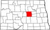 | |
| Townships |
| |
| CDP | ||
| Other communities | ||
| Indian reservation | ||
| Footnotes | ‡This populated place also has portions in an adjacent county or counties | |
| International | |
|---|---|
| National | |
This North Dakota location article is a stub. You can help Wikipedia by expanding it. |
Categories:
- Pages using gadget WikiMiniAtlas
- Webarchive template wayback links
- Use mdy dates from July 2023
- Articles with short description
- Short description is different from Wikidata
- Coordinates on Wikidata
- Articles with VIAF identifiers
- Articles with WorldCat Entities identifiers
- Articles with J9U identifiers
- Articles with LCCN identifiers
- Unincorporated communities in Wells County, North Dakota
- Unincorporated communities in North Dakota
- All stub articles
- North Dakota geography stubs