Caffee Junction, Alabama
Jump to navigation
Jump to search
Caffee Junction, Alabama | |
|---|---|
 Caffee Junction, Alabama  Caffee Junction, Alabama | |
| Coordinates: 33°13′43″N 87°08′16″W / 33.22861°N 87.13778°W | |
| Country | United States |
| State | Alabama |
| County | Tuscaloosa |
| Elevation | 653 ft (199 m) |
| Time zone | UTC-6 (Central (CST)) |
| • Summer (DST) | UTC-5 (CDT) |
| Area code(s) | 205, 659 |
| GNIS feature ID | 158836[1] |
Caffee Junction, also known as Coffey Junction, Greeley, Martaban, and Rickey, is an unincorporated community in Tuscaloosa County, Alabama, United States. Caffee Junction is located along U.S. Route 11, 4.1 miles (6.6 km) north-northeast of Woodstock.
History
The community was originally known as Greeley for the Horace Greeley school located there.[2] A post office operated under the name Rickey from 1902 to 1904, and under the name Greeley from 1904 to 1929.[3] The Tennessee Coal, Iron and Railroad Company operated an iron ore mine in Caffee Junction.[4]
References
- ^ "Caffee Junction". Geographic Names Information System. United States Geological Survey, United States Department of the Interior.
- ^ Foscue, Virginia (1989). Place Names in Alabama. Tuscaloosa: The University of Alabama Press. p. 65. ISBN 0-8173-0410-X.
- ^ "Tuscaloosa County". Jim Forte Postal History. Archived from the original on March 4, 2016. Retrieved December 1, 2015.
- ^ Statistics of the Mineral Production of Alabama for 1915. Geological Survey of Alabama. 1917. p. 2.
Municipalities and communities of Tuscaloosa County, Alabama, United States | ||
|---|---|---|
| Cities | 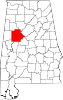 | |
| Towns | ||
| CDPs | ||
| Other unincorporated communities | ||
| Ghost town | ||
| Footnotes | ‡This populated place also has portions in an adjacent county or counties | |
This Tuscaloosa County, Alabama state location article is a stub. You can help Wikipedia by expanding it. |
Categories:
- Pages using gadget WikiMiniAtlas
- Use mdy dates from July 2023
- Articles with short description
- Short description is different from Wikidata
- Coordinates on Wikidata
- Pages using infobox settlement with possible area code list
- Unincorporated communities in Tuscaloosa County, Alabama
- Unincorporated communities in Alabama
- All stub articles
- Central Alabama geography stubs