Botkuny
Jump to navigation
Jump to search
Botkuny | |
|---|---|
Village | |
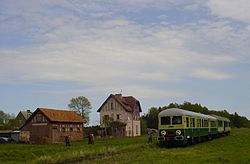
 Tourist train in Botkuny in 2003 | |
| Coordinates: 54°18′N 22°21′E / 54.300°N 22.350°E | |
| Country | |
| Voivodeship | Warmian-Masurian |
| County | Gołdap |
| Gmina | Gołdap |
Botkuny [bɔtˈkunɨ] is a village in the administrative district of Gmina Gołdap, within Gołdap County, Warmian-Masurian Voivodeship, in northern Poland, close to the border with the Kaliningrad Oblast of Russia.[1] It lies approximately 4 kilometres (2 mi) south-east of Gołdap and 134 km (83 mi) north-east of the regional capital Olsztyn.
References
Wikimedia Commons has media related to Botkuny.

