Atoyac River (Guerrero)
Jump to navigation
Jump to search
| Atoyac River (Guerrero) | |
|---|---|
| Location | |
| Country | Mexico |
| Physical characteristics | |
| Mouth | |
• coordinates | 17°56′24″N 102°08′13″W / 17.94005365895425°N 102.1368990207179°W |
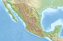
The Atoyac River is a river of Mexico located in the state of Guerrero.
In 1992's Hurricane Virgil, A flood on the Atoyac River washed away 500 homes in Guerrero, which prompted the evacuation of 2,500 people.[1]
See also
References
- ^ Edward N. Rappaport and Miles B. Lawrence (January 2, 1993). "Eastern Pacific hurricanes: 1992". Monthly Weather Review. 122. National Hurricane Center: 549. doi:10.1175/1520-0493(1994)122<0549:ENPHSO>2.0.CO;2. ISSN 1520-0493.
- Atlas of Mexico, 1975 (http://www.lib.utexas.edu/maps/atlas_mexico/river_basins.jpg)[permanent dead link].
- The Prentice Hall American World Atlas, 1984.
- Rand McNally, The New International Atlas, 1993.
Categories:
- Pages using gadget WikiMiniAtlas
- Articles with short description
- Short description matches Wikidata
- Coordinates on Wikidata
- All articles with dead external links
- Articles with dead external links from October 2016
- Articles with permanently dead external links
- Rivers of Guerrero
- All stub articles
- Mexico river stubs
