File:Map of current Interstates.svg
Jump to navigation
Jump to search

Size of this PNG preview of this SVG file: 689 × 432 pixels. Other resolutions: 320 × 201 pixels | 640 × 401 pixels | 1,024 × 642 pixels | 1,280 × 803 pixels | 2,560 × 1,605 pixels.
Original file (SVG file, nominally 689 × 432 pixels, file size: 518 KB)

|
This file requires updating because: Multiple Interstates and future Interstate are Missing In doing so, you could add a timestamp to the file.
|
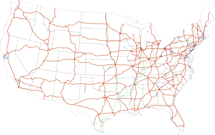
Summary
| Description |
Labels:
One or Two-digit interstates (dark orange line)
Selected three-digit interstates (blue line)
Selected planned interstates (green dashed line) |
| Date | |
| Source | National Atlas |
| Author | SPUI |
Licensing
| This work has been released into the public domain by its author, SPUI. This applies worldwide. In some countries this may not be legally possible; if so: |
| Annotations | This image is annotated: View the annotations at Commons |
File history
Click on a date/time to view the file as it appeared at that time.
| Date/Time | Thumbnail | Dimensions | User | Comment | |
|---|---|---|---|---|---|
| current | 11:19, 13 February 2013 | | 689 × 432 (518 KB) | commons>Scott5114 | Add I-49 in Missouri |
File usage
There are no pages that use this file.