File:Hopetoun falls.jpg
Jump to navigation
Jump to search

Size of this preview: 800 × 533 pixels. Other resolutions: 320 × 213 pixels | 640 × 427 pixels | 1,024 × 683 pixels | 1,280 × 853 pixels | 2,560 × 1,707 pixels | 3,072 × 2,048 pixels.
Original file (3,072 × 2,048 pixels, file size: 2.82 MB, MIME type: image/jpeg)
|

This image was selected as picture of the day on Wikimedia Commons for 17 March 2006. It was captioned as follows: English: The Hopetoun Falls is a waterfall in Victoria, Australia. Other languages:
Alemannisch: D Hepetoun-Wassrfäll in Victoria, Australie Čeština: Vodopády Hopetoun Falls ve Viktorii v Austrálii Deutsch: Die Hopetoun-Fälle in Victoria (Australien) English: The Hopetoun Falls is a waterfall in Victoria, Australia. Español: Catarata Hopetoun en Victoria (Australia) Français : Chutes d'eau d'Hopetoun (État de Victoria, Australie) Galego: Victoria, Australia Italiano: Le cascate Hopetoun, stato di Victoria, Australia Lëtzebuergesch: D'Hepetoun-Fäll, Victoria (Australien). Norsk nynorsk: Hopetounfalla i Victoria i Australia. Polski: Wodospad Hopetoun w Wiktorii (Australia) Português: A Queda de água de Hopetoun é uma cascata em Victoria, Austrália. Suomi: Hopetoun-putoukset Victoriassa, Australiassa. Български: Водопадът Хопетоун във Виктория, Австралия Русский: Водопад Хоупентон (Австралия, Виктория) العربية : ثي&é"-الا |
Summary
| Description |
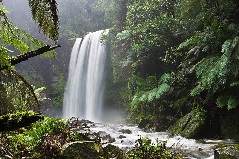
English: Hopetoun Falls, Beech Forest, near Otway National Park, Victoria, Australia. Taken with a Canon 10D and 17-40 f/4L lens.
Français : Cascade de Hopetoun, Forêt de Beech, près du Parc National d'Otway, état de Victoria, Australie. Image prise avec un Canon 10D et un objectif 17-40 f/4L.
العربية: شلالاتُ هوبتون العملاقة في غابة الزان بالقربِ من حديقة أوتواي الوطنية في مدينة فيكتوريا، أستراليا. |
| Date | |
| Source | Own work |
| Author | Diliff |
| Permission (Reusing this file) |
Summary:In using this image or any subsequent derivatives of it, you are required to release the image under the same license. As such, any reproduction of this image, in any medium, must appear with a copy of, or full URL of the license.Attribution of this image to the author (DAVID ILIFF) is also required, preferably in a prominent location near the image.No other conditions may be added to, or removed from this license without the permission of the author and copyright holder.Suggested attribution: "Photo by DAVID ILIFF. License: CC BY-SA 3.0"Please review the full license requirements carefully before using this image. If you would like to clarify the terms of the license or negotiate less restrictive commercial licensing outside of the bounds of GFDL/CC-BY-SA, please contact me by email, or if you don't have a Wikipedia account you can either leave a message on my talk page with your contact details and your request, or you can contact me on Facebook. Please also send a 'friend request' to ensure that I am aware of your message. |
| Other versions |

| Camera location | | View this and other nearby images on: OpenStreetMap |
|---|
Licensing
I, the copyright holder of this work, hereby publish it under the following licenses:
This file is licensed under the Creative Commons Attribution-Share Alike 3.0 Unported license.
Attribution: Photo by DAVID ILIFF
- You are free:
- to share – to copy, distribute and transmit the work
- to remix – to adapt the work
- Under the following conditions:
- attribution – You must give appropriate credit, provide a link to the license, and indicate if changes were made. You may do so in any reasonable manner, but not in any way that suggests the licensor endorses you or your use.
- share alike – If you remix, transform, or build upon the material, you must distribute your contributions under the same or compatible license as the original.

|
Permission is granted to copy, distribute and/or modify this document under the terms of the GNU Free Documentation License, Version 1.2 or any later version published by the Free Software Foundation; with no Invariant Sections, no Front-Cover Texts, and no Back-Cover Texts. A copy of the license is included in the section entitled GNU Free Documentation License. |
You may select the license of your choice.
File history
Click on a date/time to view the file as it appeared at that time.
| Date/Time | Thumbnail | Dimensions | User | Comment | |
|---|---|---|---|---|---|
| current | 19:06, 13 October 2009 | | 3,072 × 2,048 (2.82 MB) | commons>Diliff | Reupload original file at 3072x2048 res |
File usage
There are no pages that use this file.