File:Chiaves-la-florida-1584.jpg
Jump to navigation
Jump to search
Size of this preview: 800 × 544 pixels. Other resolutions: 320 × 218 pixels | 640 × 435 pixels | 1,024 × 696 pixels | 1,280 × 870 pixels | 2,748 × 1,868 pixels.
Original file (2,748 × 1,868 pixels, file size: 665 KB, MIME type: image/jpeg)
File history
Click on a date/time to view the file as it appeared at that time.
| Date/Time | Thumbnail | Dimensions | User | Comment | |
|---|---|---|---|---|---|
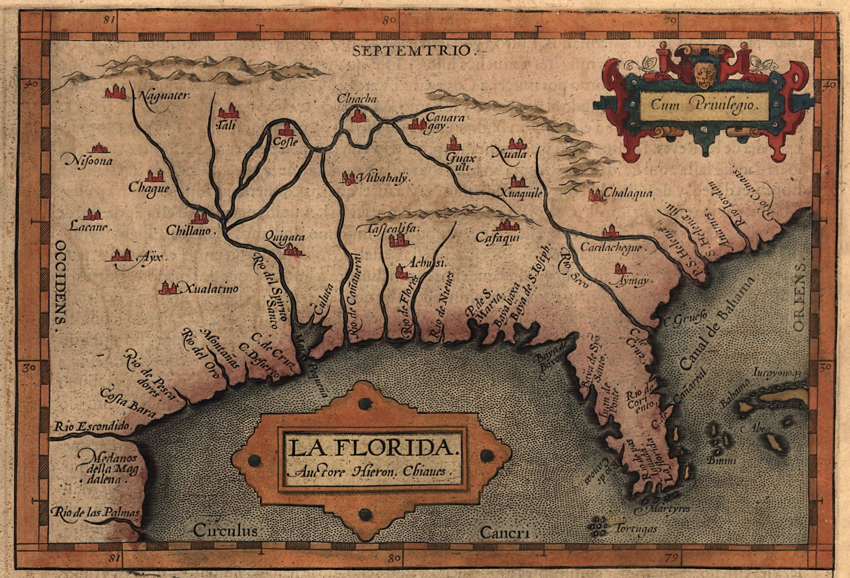
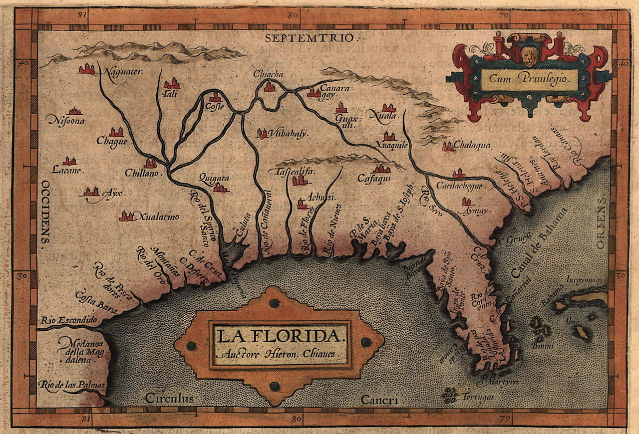
| current | 20:14, 24 April 2008 | | 2,748 × 1,868 (665 KB) | commons>BrineStans | {{Information |Description=Map of the Spanish province of "La Florida," which included most of the southeastern United States. The map was drawn by Spanish royal cartographer Geronimo Chiaves, and was probably based on accounts by members of the Hernando |
File usage
There are no pages that use this file.