Desnoeufs Island
Nickname: Île des Nœufs | |
|---|---|
 Desnœufs Island | |
| Geography | |
| Location | Indian Ocean |
| Coordinates | 06°14′S 53°32′E / 6.233°S 53.533°E |
| Archipelago | Seychelles |
| Adjacent to | Indian Ocean |
| Total islands | 1 |
| Major islands |
|
| Area | 0.457 km2 (0.176 sq mi) |
| Length | 0.75 km (0.466 mi) |
| Width | 0.7 km (0.43 mi) |
| Coastline | 2.6 km (1.62 mi) |
| Highest elevation | 5.5 m (18 ft) |
| Administration | |
| Group | Outer Islands |
| Sub-Group | Amirante Islands |
| Districts | Outer Islands District |
| Demographics | |
| Population | 0 (2014) |
| Pop. density | 0/km2 (0/sq mi) |
| Ethnic groups | Creole, French, East Africans, Indians. |
| Additional information | |
| Time zone | |
| ISO code | SC-26 |
| Official website | www |
Desnœufs Island is an island in Seychelles, lying at the southern edge of the Amirantes group, in the Outer Islands, with a distance of 321 km south of Victoria, Seychelles.
History
The origin of the name seems to be its French meaning, "one of nine", as it is one of the nine main islands of the Amirantes.[1]
Geography
Desnœufs Island is the southernmost island of the Amirantes chain, is a nearly circular island with a high rim surrounding a central depression (instead of a lagoon). It is up to 5.5 m high. Most of the land is exposed sandstone, after the guano has been exploited in the 20th century. The island has a fringing reef, and the reef flat is narrow. Landing can be extremely difficult, with heavy swells sweeping round the island even during the calmest sea conditions.[2][3]
Administration
The island belongs to Outer Islands District.[4] Being an island with a small population, there are not any government buildings or services. For many services, people have to go to Victoria, which is a difficult task.
Economics
The occasional villagers of Marie Louise Island used to poach eggs illegally on the island when the island was a base for the commercial exploitation of seabirds, especially the eggs of the sooty tern (Onychoprion fuscatus). recent years the island was made a reservation, and is visited once a year shortly by IDC members and scientists from Mahe. There are ruins on the island from the time of the poaching.
Flora and fauna
The terrestrial vegetation on the island is limited because of the high number of seabirds. The island is almost treeless and is covered by grasses and other low-growing plants. It has been identified as an Important Bird Area (IBA) by BirdLife International because it supports a breeding population of 430,000 pairs of sooty terns, and a large number of boobies. Green and hawksbill sea turtles also nest there.[5][6] The island is also known for its rich fish life.
Image gallery
-
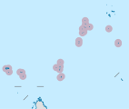
 Map 1
Map 1 -
 District Map


References
- ^ Island history
- ^ "Info on the island". Archived from the original on 2020-11-26. Retrieved 2016-04-06.
- ^ Info on the island 2 Archived April 13, 2016, at the Wayback Machine
- ^ District map
- ^ "Desnoeufs Island". Important Bird Areas factsheet. BirdLife International. 2013. Archived from the original on 2007-07-10. Retrieved 2013-08-17.
- ^ "IDC Site". Archived from the original on 2016-03-19. Retrieved 2016-04-06.
