Crash Boat Beach
Crash Boat Beach
Playa Crash Boat | |
|---|---|
 On the pier at Crash Boat Beach | |
| Commonwealth | Puerto Rico |
| Municipality | Aguadilla |
| Ideal Areas for | |
| Lifeguards | Non Available |
| Safety | For All Ages |
| Playa Crash Boat | |
|---|---|
 Location of Playa Crash Boat in Puerto Rico | |
| Location | Aguadilla, Puerto Rico |
| Coordinates | 18°27′30″N 67°09′54″W / 18.458392°N 67.164863°W |
| Part of a series on |
| Tourism in Puerto Rico |
|---|
| Tourism Regions |
| Beaches |
| Caves |
| Cays and islets |
| Convention centers |
| Culture |
| Islands |
Crash Boat Beach or Crashboat Beach (Playa Crash Boat) on the northwestern coast of Puerto Rico is situated in the municipality of Aguadilla.
Description
Crash Boat Beach is halfway between the former Ramey Air Force Base (today's Aguadilla Airport) and Aguadilla and still retains some remains of its pier infrastructure from when it was used to support Ramey Air Force Base.[1] Now these piers remains are used as a fishing and recreation spot.
The Crash Boat Beach piers / dock was originally built for use by the United States military rescue boats who raced out to sea to rescue downed airmen from Ramey Air Force Base, hence the name "Crash boat". As time passed, the local sea currents deposited tons of sand into the pier area forming into a beach, making it unusable to dock boats at the pier.[2]
Crash Boat Beach is now a tourism spot where vacationers participate in recreational activities, such as swimming, sun bathing, surfing, and snorkeling.
Gallery
-
 Bienvenidos al Crash Boat sign
 -
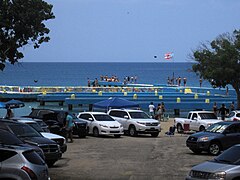 Parking area
 -
 Crash Boat, Summer 2008
 -
 Pelicans being fed on Crash Boat


See also
References
- ^ Smith, D.C. (1995). Antilles (in Danish). Vantage Press. p. 42. ISBN 978-0-533-11446-7. Retrieved 2019-07-21.
- ^ "Crash Boat – Surf Spot in Aguadilla". goseepr. 26 May 2011. Retrieved 25 May 2018.
External links
- Descubra Puerto Rico Archived 2015-09-26 at the Wayback Machine More Crash Boat Pictures
- Articles containing Spanish-language text
- CS1 Danish-language sources (da)
- Articles with short description
- Short description matches Wikidata
- Short description is different from Wikidata
- Pages using infobox settlement with no coordinates
- Coordinates on Wikidata
- Webarchive template wayback links
- Aguadilla, Puerto Rico
- Beaches of Puerto Rico
- Surfing locations in Puerto Rico