Bulow Creek State Park
| Bulow Creek State Park | |
|---|---|
IUCN category IV (habitat/species management area) | |
 | |
  | |
| Location | Volusia County, Florida, United States |
| Nearest city | Ormond Beach, Florida |
| Coordinates | 29°24′32″N 81°07′59″W / 29.40889°N 81.13306°W |
| Area | 3,230 acres (13.1 km2) |
| Established | 1981 |
| Governing body | Florida Department of Environmental Protection |
Bulow Creek State Park is a Florida State Park located five miles (8 km) north of Ormond Beach. It is on Old Dixie Highway (CR 4011), next to the Atlantic Ocean. The park is adjacent to Bulow Plantation Ruins Historic State Park, and close to North Peninsula State Park, Gamble Rogers Memorial State Recreation Area and Tomoka State Park.
Ecology
Flora
Containing one of the largest stands of southern live oak remaining on the east coast of Florida, the park's "star" is the Fairchild Oak. Over four centuries old, it is among the largest of its kind in the southern United States.
Fauna
Among the wildlife of the park are white-tailed deer, barred owls and raccoons.
Recreational activities
Activities include hiking, canoeing, picnicing, wildlife viewing and primitive camping. Amenities include nature trails, a picnic pavilion and a primitive campsite. The Bulow Woods Trail, more than six miles (10 km) long, leads to Bulow Plantation Ruins Historic State Park.
Hours
Florida state parks are open between 8 a.m. and sundown every day of the year (including holidays).
Gallery
-
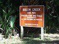 Park sign
 -
 Fairchild Oak
 -
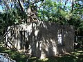 Conrad-Oates building


References
- Articles with short description
- Short description matches Wikidata
- Use mdy dates from August 2023
- IUCN Category IV
- Coordinates on Wikidata
- Commons category link from Wikidata
- State parks of Florida
- Parks in Volusia County, Florida
- Protected areas established in 1981
- Ormond Beach, Florida
- 1981 establishments in Florida
- All stub articles
- Volusia County, Florida geography stubs