File:ZimbabweOMC.png
Jump to navigation
Jump to search
Size of this preview: 724 × 600 pixels. Other resolutions: 290 × 240 pixels | 579 × 480 pixels | 939 × 778 pixels.
Original file (939 × 778 pixels, file size: 36 KB, MIME type: image/png)
File history
Click on a date/time to view the file as it appeared at that time.
| Date/Time | Thumbnail | Dimensions | User | Comment | |
|---|---|---|---|---|---|
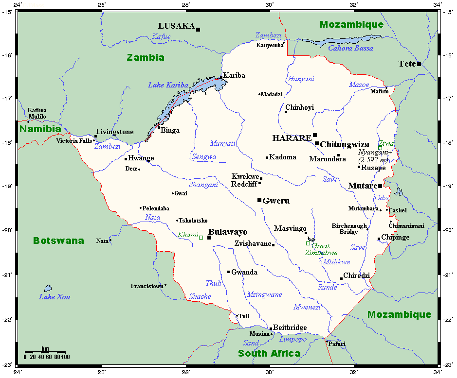
| current | 07:28, 23 December 2011 | | 939 × 778 (36 KB) | commons>Urdangaray | {{Information |Description={{en|A map showing Zimbabwe's cities, main towns, selected villages, rivers, selected archaeological sites and its highest peak. This map's source is [http://www.aquarius.ifm-geomar.de/ here], with the uploader's modifications, |
File usage
There are no pages that use this file.