File:Yellowstone Caldera map2.jpg
Jump to navigation
Jump to search
Size of this preview: 743 × 600 pixels. Other resolutions: 298 × 240 pixels | 595 × 480 pixels | 952 × 768 pixels | 1,269 × 1,024 pixels | 2,538 × 2,048 pixels | 3,072 × 2,479 pixels.
Original file (3,072 × 2,479 pixels, file size: 2.42 MB, MIME type: image/jpeg)
File history
Click on a date/time to view the file as it appeared at that time.
| Date/Time | Thumbnail | Dimensions | User | Comment | |
|---|---|---|---|---|---|
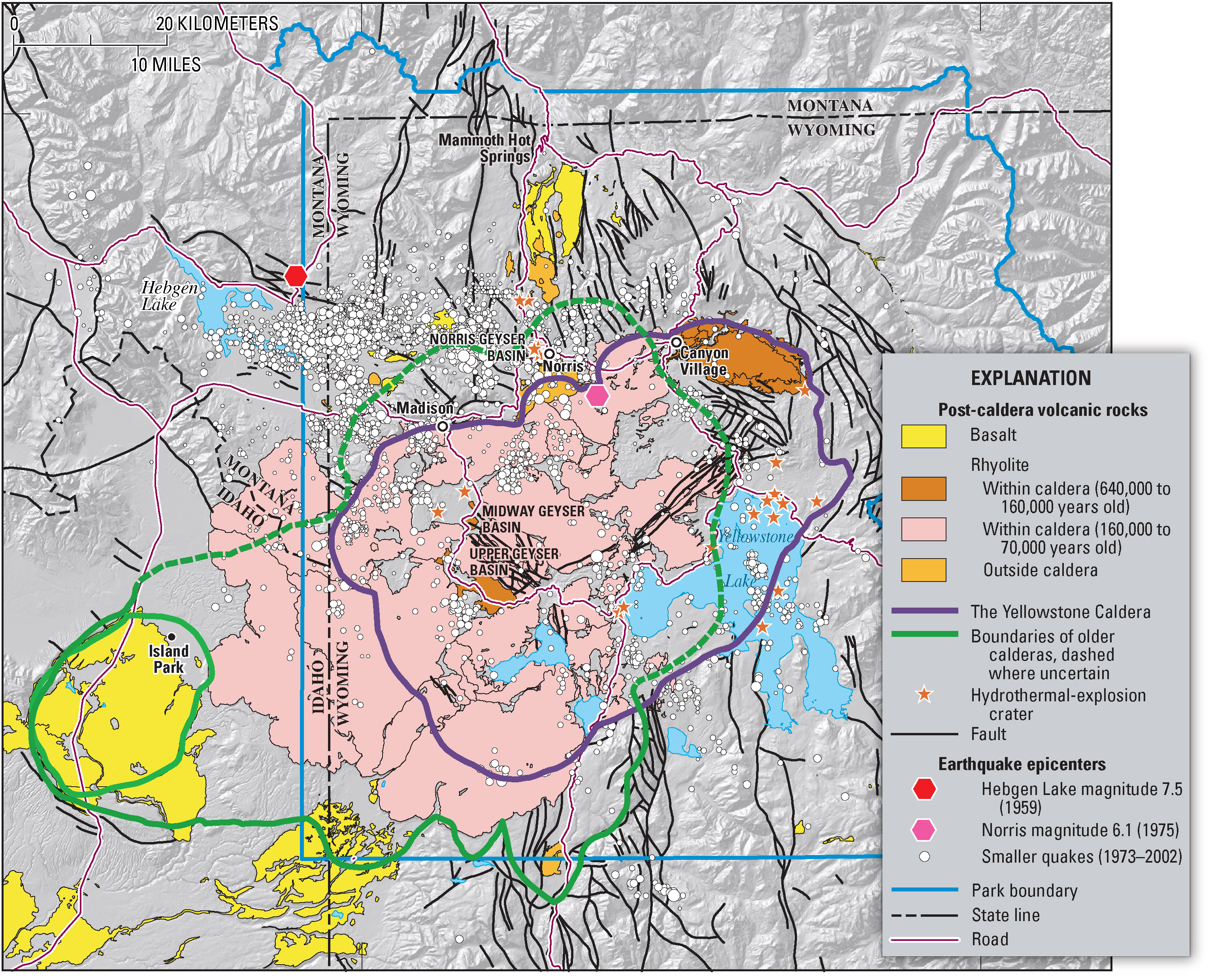
| current | 07:49, 16 February 2006 | | 3,072 × 2,479 (2.42 MB) | commons>Napa | Geologic information regarding Yellowstone Caldera. From USGS. [http://pubs.usgs.gov/fs/2005/3024/press-images/fig_03_yellowstone_map.jpg] {{PD-USGov-Interior-USGS}} Category:Geography of the United States Category:Maps of the United States |
File usage
There are no pages that use this file.