File:Wolfe Island 1878 map.jpg
Jump to navigation
Jump to search

Size of this preview: 800 × 482 pixels. Other resolutions: 320 × 193 pixels | 640 × 385 pixels | 1,024 × 617 pixels | 1,280 × 771 pixels | 2,560 × 1,541 pixels | 4,599 × 2,769 pixels.
Original file (4,599 × 2,769 pixels, file size: 4.95 MB, MIME type: image/jpeg)
File history
Click on a date/time to view the file as it appeared at that time.
| Date/Time | Thumbnail | Dimensions | User | Comment | |
|---|---|---|---|---|---|
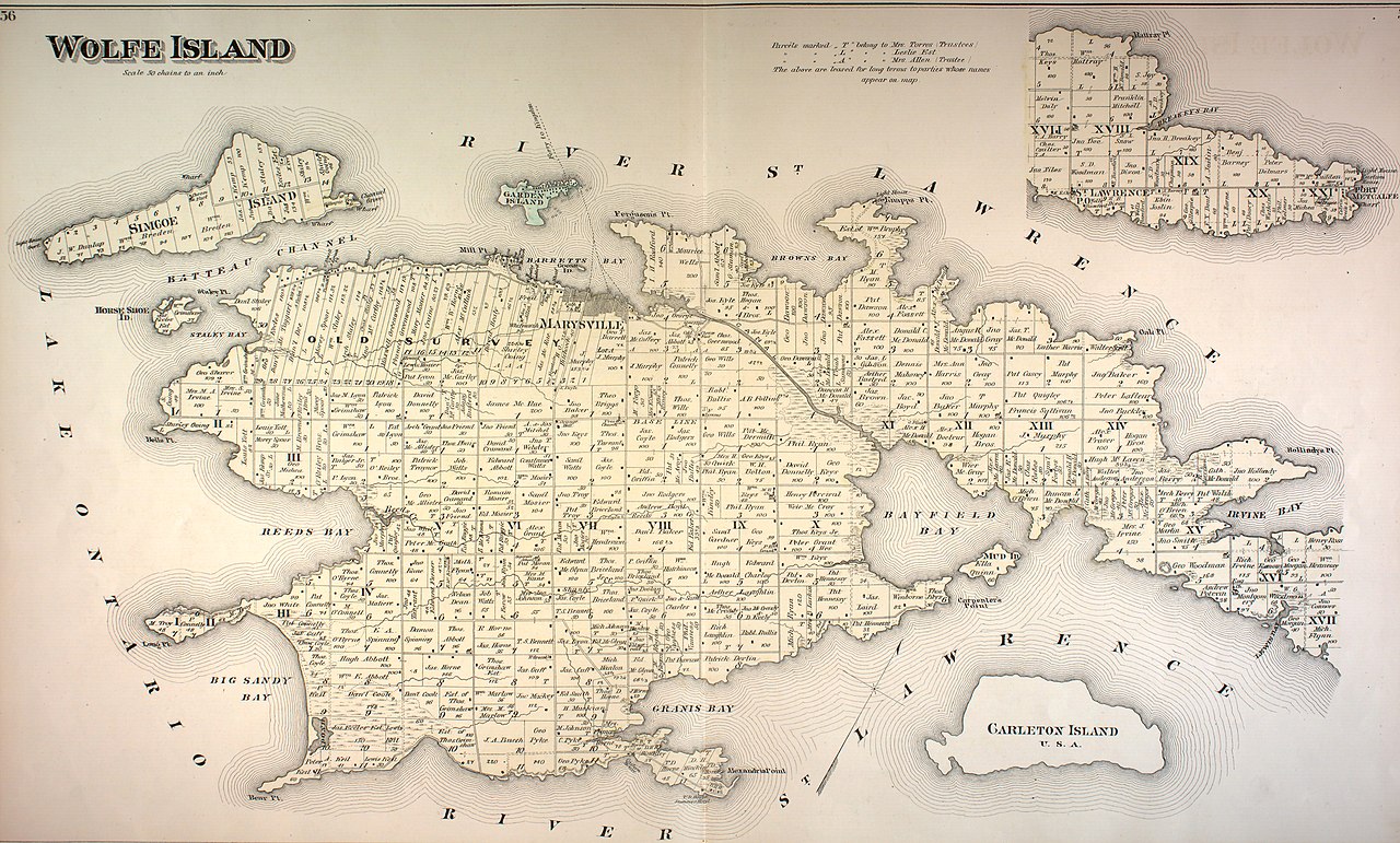
| current | 18:22, 8 April 2017 | | 4,599 × 2,769 (4.95 MB) | commons>AjaxSmack | {{Information |Description ={{en|1=1878 map of '''Wolfe Island''', Ontario, Canada, from "Frontenac, Lennox and Addington Counties." ''Illustrated historical atlas of the counties of Frontenac, Lennox and Addington, On... |
File usage
There are no pages that use this file.