File:Whetstonemnrivermap.png
Jump to navigation
Jump to search
No higher resolution available.
Whetstonemnrivermap.png (500 × 500 pixels, file size: 142 KB, MIME type: image/png)
File history
Click on a date/time to view the file as it appeared at that time.
| Date/Time | Thumbnail | Dimensions | User | Comment | |
|---|---|---|---|---|---|
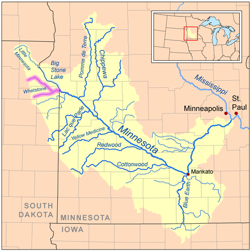
| current | 15:33, 5 June 2008 | | 500 × 500 (142 KB) | commons>Kmusser | == Summary == {{Information |Description=Map of the Minnesota River watershed with the Whetstone River highlighted (including the North and South forks). |Source=Self-made, based on USGS data. | |
File usage
There are no pages that use this file.