File:Water stress 2019 WRI.png
Jump to navigation
Jump to search
Size of this preview: 800 × 351 pixels. Other resolutions: 320 × 140 pixels | 640 × 281 pixels | 1,425 × 625 pixels.
Original file (1,425 × 625 pixels, file size: 54 KB, MIME type: image/png)
File history
Click on a date/time to view the file as it appeared at that time.
| Date/Time | Thumbnail | Dimensions | User | Comment | |
|---|---|---|---|---|---|
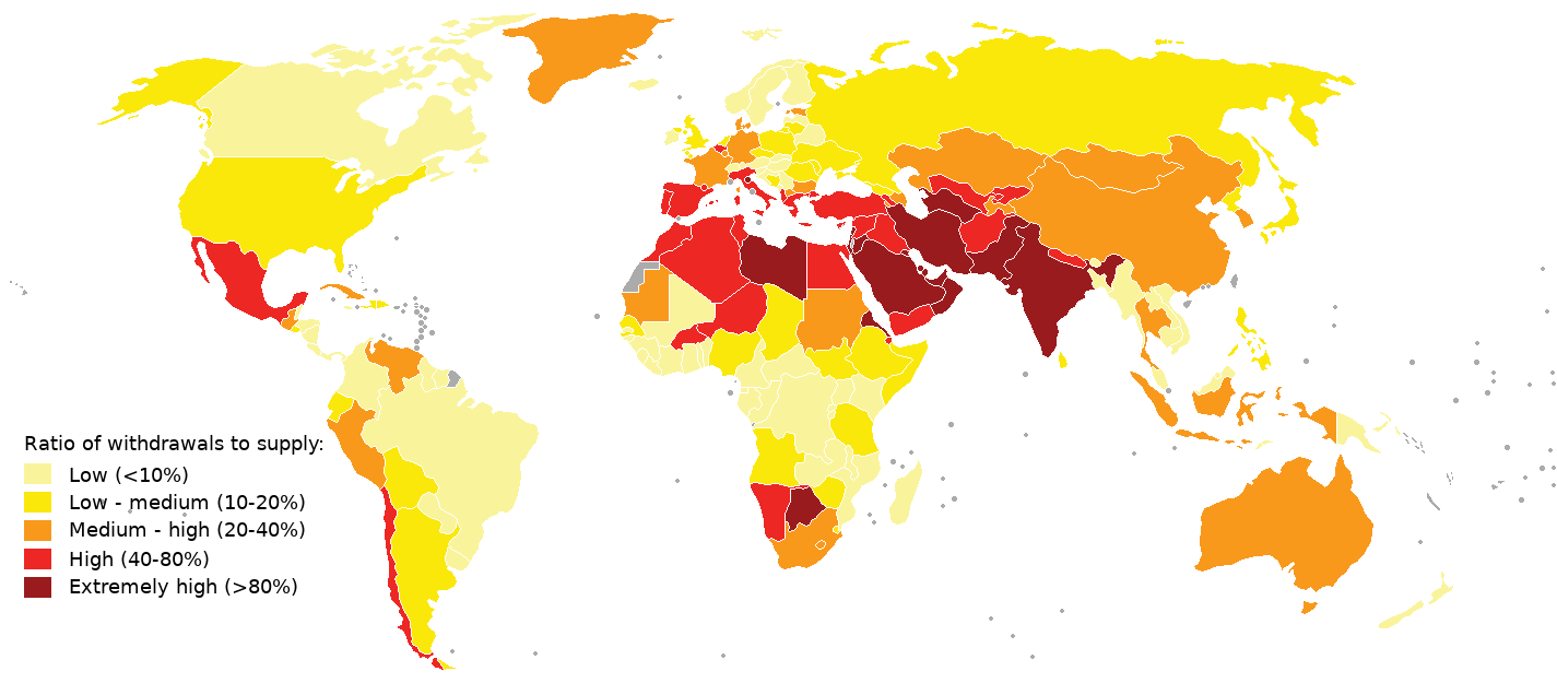
| current | 13:38, 11 August 2019 | | 1,425 × 625 (54 KB) | commons>Genetics4good | {{Information |description ={{en|1=2019 water stress map. Compiled using aqueduct 3.0 data from World Resources Institute See table "National Water Stress Rankings" at https://www.wri.org/blog/2019/08/17-countries-home-one-quarter-world-population-face-extremely-high-water-stress and https://www.wri.org/applications/aqueduct/country-rankings/ Legend was made similar as in an earlier WRI map (aqueduct 2.0), see https://www.wri.org/resources/data-sets/aqueduct-projected-water-stress-country-r... |
File usage
There are no pages that use this file.