File:UsedomWolin.png
Jump to navigation
Jump to search
No higher resolution available.
UsedomWolin.png (543 × 419 pixels, file size: 12 KB, MIME type: image/png)
File history
Click on a date/time to view the file as it appeared at that time.
| Date/Time | Thumbnail | Dimensions | User | Comment | |
|---|---|---|---|---|---|
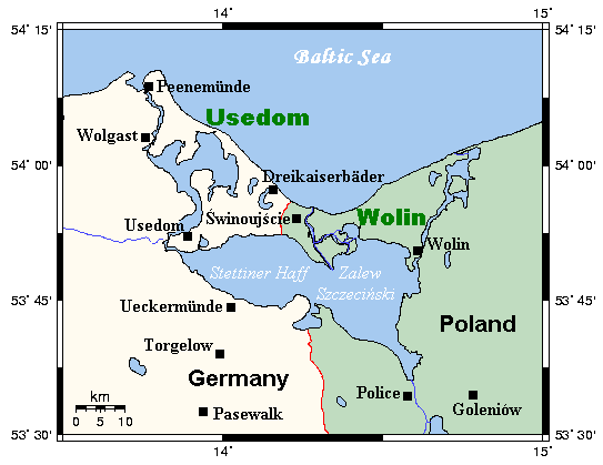
| current | 16:43, 30 May 2007 | | 543 × 419 (12 KB) | commons>Frokor | {{Information |Description=A map of the islands of Usedom and Wolin and environs, Germany/Poland. This map's source is [http://www.aquarius.geomar.de/omc/make_map.html here], with the uploader's modifications, and the [http://gmt.soest.hawaii.edu/ GMT hom |
File usage
There are no pages that use this file.