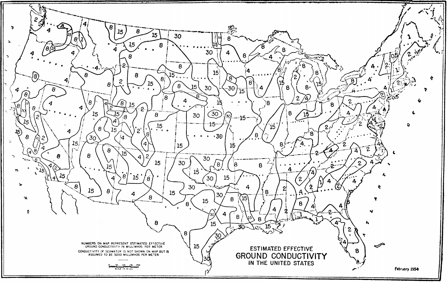
File:United States Effective Ground Conductivity Map.png
Jump to navigation
Jump to search
Size of this preview: 800 × 505 pixels. Other resolutions: 320 × 202 pixels | 640 × 404 pixels | 1,024 × 646 pixels | 1,544 × 974 pixels.
Original file (1,544 × 974 pixels, file size: 499 KB, MIME type: image/png)
File history
Click on a date/time to view the file as it appeared at that time.
| Date/Time | Thumbnail | Dimensions | User | Comment | |
|---|---|---|---|---|---|
| current | 19:29, 8 February 2013 | | 1,544 × 974 (499 KB) | commons>Runxctry | {{subst:Upload marker added by en.wp UW}} {{Information |Description = {{en|United States Effective Ground Conductivity Map}} |Source = http://edocket.access.gpo.gov/cfr_2011/octqtr/pdf/47cfr73.190.pdf |Date = 02/1950 |Author = United States Federal Go... |
File usage
There are no pages that use this file.