File:United States 1898-1907.png
Jump to navigation
Jump to search
Size of this preview: 800 × 542 pixels. Other resolutions: 320 × 217 pixels | 640 × 433 pixels | 1,000 × 677 pixels.
Original file (1,000 × 677 pixels, file size: 105 KB, MIME type: image/png)
File history
Click on a date/time to view the file as it appeared at that time.
| Date/Time | Thumbnail | Dimensions | User | Comment | |
|---|---|---|---|---|---|
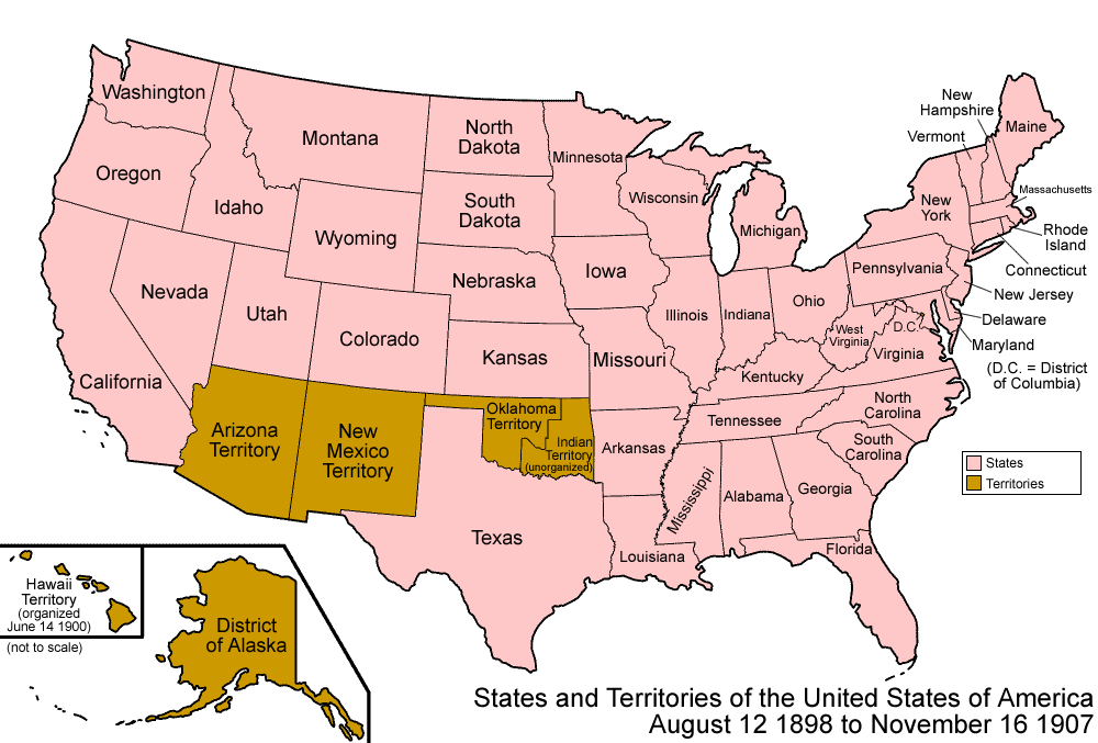
| current | 08:41, 29 July 2006 | | 1,000 × 677 (105 KB) | commons>Golbez | {{Information| |Description=Map of the states and territories of the United States as it was from May 1896 to 1898. On May 4 1896, the Greer County question was finally answered, in Oklahoma Territory's favor. On August 12 1898, |Source= |Date= |Author=M |
File usage
There are no pages that use this file.