File:USA Territorial Growth 1850.jpg
Jump to navigation
Jump to search

Size of this preview: 800 × 352 pixels. Other resolutions: 320 × 141 pixels | 640 × 282 pixels | 1,400 × 616 pixels.
Original file (1,400 × 616 pixels, file size: 124 KB, MIME type: image/jpeg)
File history
Click on a date/time to view the file as it appeared at that time.
| Date/Time | Thumbnail | Dimensions | User | Comment | |
|---|---|---|---|---|---|
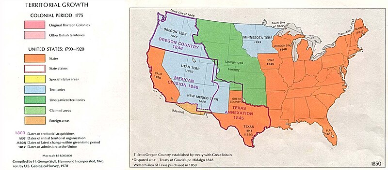
| current | 06:18, 4 October 2005 | | 1,400 × 616 (124 KB) | commons>Lordkinbote~commonswiki | Map of U.S. Territorial Growth (1850) from the Perry-Castañeda Library Map Collection. This image can be found at [http://www.lib.utexas.edu/maps/united_states/us_terr_1850.jpg]. |
File usage
There are no pages that use this file.