File:USATopographicalMap.jpg
Jump to navigation
Jump to search
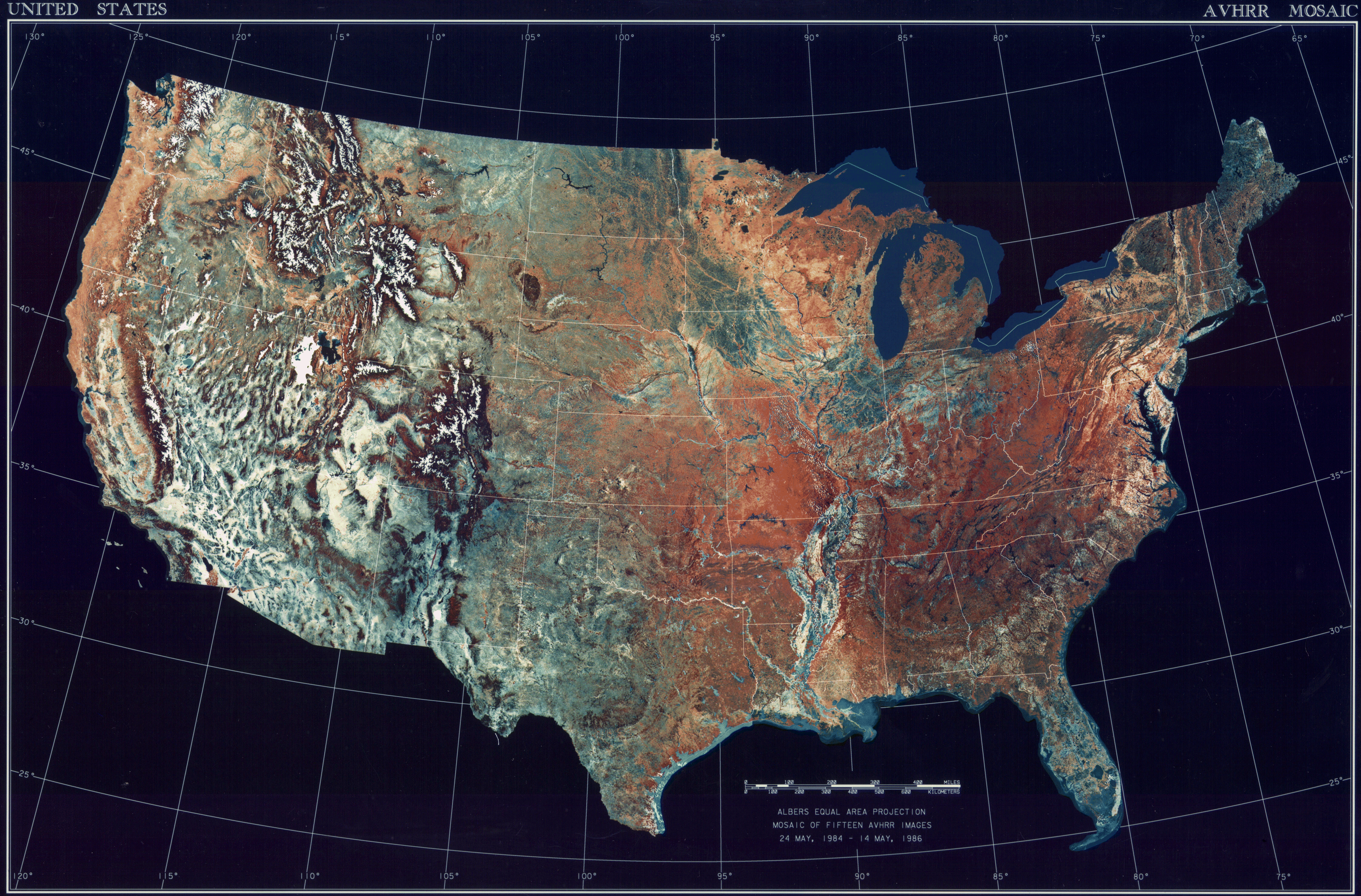
Size of this preview: 800 × 527 pixels. Other resolutions: 320 × 211 pixels | 640 × 422 pixels | 1,024 × 674 pixels | 1,280 × 843 pixels | 2,560 × 1,686 pixels | 3,199 × 2,107 pixels.
Original file (3,199 × 2,107 pixels, file size: 11.19 MB, MIME type: image/jpeg)
File history
Click on a date/time to view the file as it appeared at that time.
| Date/Time | Thumbnail | Dimensions | User | Comment | |
|---|---|---|---|---|---|
| current | 08:06, 25 October 2013 | | 3,199 × 2,107 (11.19 MB) | commons>McZusatz | compression (uploaded using chunked upload script) |
File usage
There are no pages that use this file.